Shapefiles in Google Earth


Last week I put together a presentation about our Michigan UP Ecological-Economic Modeling project for our funding body. I thought it would be useful to demonstrate the location of our study area in Google Earth, so I set about learning how to import ESRI shapefiles into Google Earth. I discovered it’s really easy.

My first stop in working this out was ‘Free Geography Tools‘ and their series of posts about exporting shapefiles to Google Earth. From their list of free programs, first I tried Shp2KML by Jacob Reimers. Unfortunately this program resulted in some security conflicts with our network so I couldn’t use it. Next I tried a second program, also called shp2kml, from Zonum Solutions and that worked a treat. Zonum have several other Google Earth tools that I’ll have to try out sometime.

You can download the kml file it produced for the boundary of our study area here (right click, ‘save as’ or whatever). If you have Google Earth installed you can then just double click that file (once downloaded) and Google Earth will take you right there. When I first created the link above, I hoped that when you clicked on it the file would open automatically in Google Earth – it didn’t. But after a little playing I found that kmz files will open automatically in Google Earth. kmz files are simply zipped (compressed) kml files – I used WinRar to zip the kml file and then changed the file suffix from zip to kmz. Click here – the study area file will open automatically in Google Earth (from Firefox at least – see note below). Sweet.

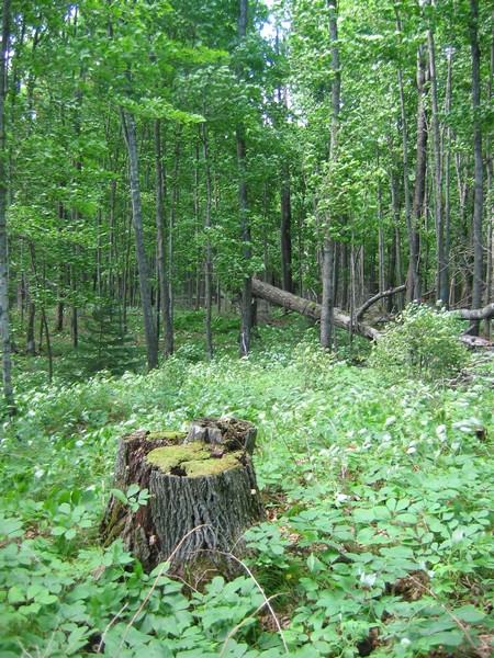
I also exported shapefiles for DNR and private industrial stand boundaries which match up nicely with spatial patterns of vegetation observed in the landscape. Obviously, I can’t post these shapefiles online, but you can see evidence of land ownership boundaries in our study area right here. The light green rectangular area is non-DNR land and has been clear cut. The surrounding area is managed by the DNR (possibly selective timber harvest) – the resulting land cover from different management approaches is stark. These are the sorts of patterns and issues we will be able to examine using our ecological-economic landscape model.

[Note – When posting the presentation to our web server I also learned about MS Internet Explorer .png issues. They say they’ve fixed them, but there still seem to be some problems – try viewing this page in both IE and Firefox and note the difference (hover your cursor over the words at the bottom). Viewing the presentation pages in Firefox means the links to the .kmz files are active – they are not in IE. The issue arose becasue I used OpenOffice Impress to convert my MS PowerPoint file to html files.]

Columbia University Press Sale


Columbia University Press currently has a sale on. They have savings of up to 80% on more than 1,000 titles from several fields of study. I was particularly interested in their books in the Environmental Studies and Ecology section and purchased several:

Previously on this blog I reviewed another book they have on sale, Useless Arithmetic: Why Environmental Scientists Can’t Predict the Future by Orrin H. Pilkey and Linda Pilkey-Jarvis.

When I get round to reading this new batch I’ll review some of these also (at first glance the Wiens et al. book looks particularly useful for any Landscape Ecologist – student, teacher or researcher). You’ve got up until May 31st to order yours.

Bristol, UK. Whence I came.

Amazingly it’s just over a year since I arrived in Michigan and started my postdoc at MSU. Time flies when you’re having fun, eh? Well, the first few months didn’t fly so fast… but it’s been fairly well shooting by recently. That’s not to say I don’t miss home everynowandthen. Especially when I see videos like this about my hometown:

http://www.bristol.ac.uk/university/media/bristol/bristol.swf
[From University of Bristol and DestinationBristol]

But I do remember Bristol – it’s not that sunny ALL the time. 😉

Michigan UP Seedling Experiment

I’ve been back from our study area in Michigan’s Upper Peninsula for over a week so it’s about time I posted something about what we were doing up there.

One of the main issues we will study with our integrated ecological-economic landscape model is the impact of whitetail deer (Odocoileus virginianus) herbivory on tree regeneration following cutting. Last November we spent a week planting 2 year-old seedlings in Northern Hardwood forest gaps created by selective timber harvest (like the one in the photo below).

Our plan was to return this spring to examine the impacts of deer browse on these seedlings. In particular, we wanted to examine how herbivory varies across space due to changes in deer population densities (in turn driven by factors such as snow depth).

To this end we selected almost 40 forest sites that would hopefully capture some spatial variation in snowfall and that had recently been selectively harvested. At each site we selected 10 gaps produced by timber harvest in which to plant our seedlings.

In each gap we planted six trees of each of three species: White Spruce (Picea glauca), White Pine (Pinus strobus) and Eastern Hemlock (Tsuga canadensis). We chose these coniferous species as these are examples of the mesic confer species the Michigan DNR are trying to restore across our study area, and because we expected a range of herbivory across these species.

At each site we would also undertake deer pellet counts in the spring to estimate the number of deer in the vicinity of the site during the winter (during which time the browse we were measuring would have occurred).

On returning to the study sites a couple of weeks ago we set about looking for the trees we had planted to measure herbivory and count deer pellets. In some cases, finding the trees we planted was easier said than done. We tried to get our field crews to plant the trees in straight lines with equal spacing between each tree. In general, this was done well but on occasion the line could only be described as crooked at best. Micro-topography, fallen tree trunks and limbs, and slash from previous cutting all contributed to hamper the planned planting system. However, we did pretty well and found well over 90% of the trees.

We haven’t begun analyzing our data as yet, but some anecdotal observations stand out. First, the deer preferentially browsed Hemlock over the other species, often removing virtually all non-woody biomass as shown by the ‘before and after’ examples below (NB – these photographs are not of the same tree and this is not a true before/after comparison).

In some cases, the deer not only removed all non-woody biomass but also pulled the tree out of the ground (as shown below).

In contrast, White Pine was browsed to a much lesser extent and White Spruce was virtually untouched (as shown below).

Having a species that was unaffected by deer (i.e. spruce) often made our job of finding the other trees much easier. Finding heavily browsed Hemlock that no longer had any green vegetation was often tricky against a background of forest floor litter.

The next step now is to start looking at this variation in browse through a more quantitative lens. Then we can start examining how browse and deer densities vary across space and how these variables are related to one another and other factors (such as snow depth and distance to conifer stands).

All-in-all the two weeks of work went pretty well. There were some issues with water-logged roads (due to snow melt) meaning we couldn’t get to one or two of the sites we planted at, but generally the weather was pretty good (it only rained heavily one day). I’ll write more once we have done more analysis and stop here with a shot I took at sunrise as I left for home.

Earthquake hits Wolong

I’m totally behind on posting this: the earthquake that hit China earlier this week is in the region where CSIS does its research on Giant Pandas – the Wolong Panda Reserve. Two of my colleagues and friends, Wei Liu and Mao-Ning Tuan Mu, were in the region when the ‘quake hit. They, along with Yu “Chris” Li who is also in the area (in the city of Chengdu) survived and are well. They are currently helping out with the relief effort – inevitably their fieldwork has been put on hold.

The ‘To catch a panda’ website I highlighted previously will be updated as news is received. The CSIS HELP PANDA fund, set up to enable those interested in the understanding and preservation of giant panda habitat to help the area, has been expanded to allow people to help both earthquake victims and the area. Tax-deductable donations can be made on the site.

Michigan UP Deer Distribution Fieldwork

I’m back in the UP for more fieldwork. Last time I was up here was right before the start of hunting season last year. Since then a hard winter has passed and is now just being replaced by spring. There’s still snow on the ground in the northern areas of our study area, but it’s melting fast. Over the next couple of weeks we’ll be doing deer pellet counts (as a proxy for numbers of deer) to supplement previous data and to try to get a better gauge on how snowfall affects the spatial distribution of deer during the winter. We need to do these as soon after the snow melts before ground level vegetation re-grows and obscures the pellets. We’re also going to count pellets in the stands where we planted tree seedlings last fall. Then we’ll compare the estimated deer numbers in the stands with the browse on the seedlings we planted (if there’s anything left of them at all!) to try to get a more precise handle on how deer density relates to browse impact of different species.

So that’s my next few weeks – counting deer poo in the UP forests. I doubt I’ll be online much so this might be the last blog for a week or two. I’ll take some photos and maybe post them when I’m back in Lansing.

US-IALE 2008 – Summary


A brief and belated summary of the 23rd annual US-IALE symposium in Madison, Wisconsin.

The theme of the meeting was the understanding of patterns, causes, and consequences of spatial heterogeneity for ecosystem function. The three keynote lectures were given by Gary Lovett, Kimberly With and John Foley. I found John Foley’s lecture the most interesting and enjoyable of the three – he’s a great speaker and spoke on a broader topic than the the others; Agriculture, Land Use and the Changing Biosphere. Real wide-ranging, global sustainability stuff. He highlighted the difficulties of studying agricultural landscapes because of the human cultural and institutional factors, but also stressed the importance of tackling these tricky issues because ‘agriculture is the largest disturbance the biosphere has ever seen’ and because of its large contribution to greenhouse gas emissions.

Presentations I was particularly interested in were mainly in the ‘Landscape Patterns and Ecosystem Processes: The Role of Human Societies’, ‘Challenges in Modeling Forest Landscapes under Climate Change’ and ‘Cross-boundary Challenges to the Creation of Multifunctional Agricultural Landscapes’ sessions.

In the ‘human societies’ session, Richard Aspinall discussed the importance of considering human decision-making at a range of scales and Dan Brown again highlighted the importance of human agency in spatial landscape process models. In particular, with regards modelling these systems using agent-based approaches he discussed the difficulty of model calibration at the agent level and stressed that work is still needed on the justification and evaluation phases of agent-based modelling.

The ‘modeling forest landscapes’ session was focused largely around use of the LANDIS and HARVEST models that were developed in and around Wisconsin. In fact, I don’t think I saw any mention of the USFS FVS at the meeting whilst I was there, largely because (I think) FVS has large data demands and is not inherently spatial. LANDIS and HARVEST work at more coarse levels of forest representation (grid cell compared to FVS’ individual tree) allowing them to be spatially explicit and to run over large time and space extents. We’re confident we’ll be able to use FVS in a spatially explicit manner for our study area though, capitalising on the ability of FVS to directly simulate specific timber harvest and economic scenarios.

The ‘multifunctional agricultural landscapes’ session had an interesting talk by Joan Nassauer on stakeholder science and the challenges it presents. Specific issues she highlighted were:
1. the need for a precise, operational definition of ‘stakeholder’
2. ambiguous goals for the use of stakeholders
3. the lack of a canon of replicable methods
4. ambivalence toward the quantification of stakeholder results

Other interesting presentations were given by Richards Hobbs and Carys Swanwick. Richard spoke about the difficulties of ‘integrated research’ and the importance of science and policy in natural resource management. He suggested that policy-makers ‘don’t get’ systems thinking or modelling, and that some of this may be down to the psychological profiles of the types of people that go into policy making. Such a conclusion suggests scientists need to work harder to bridge the gap to policy makers and do a better job of explaining the emergent properties of the complex systems they study. Carys Swanwick talked about the landscape character assessment, which was interesting for me having moved from the UK to the US about a year ago. Whilst ‘wilderness’ is an almost alien concept in the UK (and Europe as a whole), landscape character is something that is distinctly absent in the new world agricultural landscapes. Carys talked about the use of landscape character as a tool for conservation and management (in Europe) and the European Landscape Convention. It was a refreshing change from many of the other presentations about agricultural landscape (possibly just because I enjoyed seeing a few pictures of Blighty!).

Unfortunately the weather during the conference was wet which meant that I didn’t get out to see as much of Madison as I would have liked. Despite the rain we did go on the Biking Fieldtrip. And yes, we did get soaked. It was also pretty miserable weather for the other fieldtrip to and International Crane Foundation center and the Aldo Leopold Foundation (more on that in a future blog), but interesting nevertheless.

Other highlights of the conference for me were meeting the former members of CSIS and eating dinner one night with Monica Turner. I also got to meet up with Don McKenzie and some of the other ‘fire guys’, and a couple of people from the Great Basin Landscape Ecology lab where I visited previously. And now I’m already looking forward to the meeting next year in Snowbird, Utah (where I enjoyed the snow this winter).

April 2008 Conference Posters


Final preparations are underway for the US-IALE Symposium in Madison, WI, next week. I’ve finished the poster that we’ll be presenting there on the progress we’re making withour ecological-economic forest landscape model. We’ve also been putting the finishing touches on our posters for the wildfire session at EGU in Vienna (which Raul will be attending and presenting our posters at). Links to .pdf versions of the posters are below. Thoughts and photos from Madison and Chicago (where I’ll be stopping off for a couple of days on the way home) on my return.

An Ecological-Economic Model for Sustainable Forest Management: Modeling Deer Distributions from Local & Landscape Characteristics
J.D.A. Millington, J.P. LeBouton, M.B. Walters, K.R. Hall, M.S. Matonis, E.J. Laurent, F. Lupi, S. Chen, J. Liu

An Integrated Socio-Ecological Simulation Model of Succession-Disturbance Dynamics in a Mediterranean Landscape
J.D.A. Millington, J. Wainwright, G.L.W. Perry, R. Romero-Calcerrada, & B.D. Malamud

Spatial modelling of the influence of human activity on wildfire ignition risk in a Mediterranean landscape
R. Romero-Calcerrada, F. Barrio-Parra, J.D.A. Millington, C.J. Novillo

XIII World Forestry Congress 2009


The call for papers for the XIII World Forestry Congress is now open. To be held in Buenos Aires, Argentina, in October 2009 the congress will address “the sustainable development of forests from a global and integral perspective”. Authors are invited to submit papers and posters expressing new ideas and providing information on experiences, theoretical models and interesting initiatives. Papers will be published in the Congress Proceedings and on the Congress’ official website.