Traditional Fire Knowledge in Spain

When you haven’t done something for a while it’s often best not to rush straight back in at the intensity you were at before. So here’s a nice easy blog to get me going again (not that I was blogging intensely before!).

I didn’t blog about it at the time (unsurprisingly), but back in late June 2013 I went to visit a colleague of mine in Madrid, Dr Francisco Seijo. Francisco and I met back at something I did blog about, the 2009 US-IALE conference in Snowbird. Since then we’ve been discussing how we can use the idea of coupled-human and natural systems to investigate Mediterranean landscapes.

Example of Traditional Fire Knowledge. The ‘pile-burning’ technique involves raking, piling and igniting leaves. This contrasts with ‘a manta’ broadcast burning in which leaves and ground litter are burned across larger areas. Photos by the authors of the paper.

After a brief field visit by me, an interview campaign by Francisco, collection of secondary data from other sources (aerial photography and official fire statistics) and some desk analysis, we recently published our first paper on the work. Entitled Forgetting fire: Traditional fire knowledge in two chestnut forest ecosystems of the Iberian Peninsula and its implications for European fire management policy, and published in the journal Land Use Policy, the article presents the results of our mixed-methods and interdisciplinary approach. Building on Francisco’s previous examination of ‘pre-industrial anthropogenic fire regimes’ we to to investigate differences between the fire regimes and management approaches of chestnut forest ecosystems in two municipalities in central Spain. In the paper we also discuss ideas of Traditional Ecological Knowledge (TEK), the related idea of Traditional Fire Knowledge (TFK), and discuss them in light of contemporary fire management approaches in Europe.

The full abstract is below with links to the paper. I’ll stop here now as this rate of blogging it making me quite dizzy (but hopefully I’ll be back for more soon).

—-

Seijo, Francisco, James DA Millington, Robert Gray, Verónica Sanz, Jorge Lozano, Francisco García-Serrano, Gabriel Sangüesa-Barreda, and Jesús Julio Camarero (2015) Forgetting fire: Traditional fire knowledge in two chestnut forest ecosystems of the Iberian Peninsula and its implications for European fire management policy. Land Use Policy 47 130-144. doi: 10.1016/j.landusepol.2015.03.006
[Online] [Pre-print]

Abstract

Human beings have used fire as an ecosystem management tool for thousands of years. In the context of the scientific and policy debate surrounding potential climate change adaptation and mitigation strategies, the importance of the impact of relatively recent state fire exclusion policies on fire regimes has been debated. To provide empirical evidence to this ongoing debate we examine the impacts of state fire exclusion policies in the chestnut forest ecosystems of two geographically neighbouring municipalities in central Spain, Casillas and Rozas de Puerto Real. Extending the concept of ‘Traditional Ecological Knowledge’ to include the use of fire as a management tool as ‘Traditional Fire Knowledge’ (TFK), we take a mixed-methods and interdisciplinary approach to argue that currently observed differences between the municipalities are useful for considering the characteristics of “pre-industrial anthropogenic fire regimes” and their impact on chestnut forest ecosystems. We do this by examining how responses from interviews and questionnaire surveys of local inhabitants about TFK in the past and present correspond to the current biophysical landscape state and recent fire activity (based on data from dendrochronological analysis, aerial photography and official fire statistics). We then discuss the broader implications of TFK decline for future fire management policies across Europe particularly in light of the published results of the EU sponsored FIRE PARADOX research project. In locations where TFK-based “pre-industrial anthropogenic fire regimes” still exist, ecosystem management strategies for adaptation and mitigation to climate change could be conceivably implemented at a minimal economic and political cost to the state by local communities that have both the TFK and the adequate social, economic and cultural incentives to use it.

Key words

Fire exclusion policies; traditional ecological knowledge; traditional fire knowledge; Chestnut forest ecosystems; FIRE PARADOX


Morocco Fieldtrip Recon

I spent a couple of weeks this month in Morocco, the majority of which was scouting out a route for a new physical geography fieldtrip for second year undergraduates at King’s College London. For the last several years the physical geography fieldtrip has been based on the Morocco coast at Agadir and Essaouira, visiting nearby sites. The new fieldtrip will take more of a transect approach, starting in Marrakech, traversing the High Atlas mountains and following the River Draa out to the edge of the Sahara (see map below).


As we work our way up and through the High Atlas one of the things we’ll consider is how vegetation changes and what might be driving those changes. In the picture below you can see colleagues on the trip Prof. Drake and Dr Chadwick (@DrMChad) debating (and betting on!) vegetation on the hills over-looking the town of Demnate.

For example, what are the relative influences of climate and human activity on the vegetation we see? In the picture below Prof Drake confronts one potential disturbance.

As this is a new trip and we’ll be staying in a new location each night, one of our tasks was to check the accommodation we’ll be staying in. Here hotel connoisseurs Drake and Chadwick relax in luxury in the gîte at Toufghine.

There’s some impressive geology in the High Atlas and we’ll discuss that as we go too. The scale of some of the tectonic features is illustrated by Prof Drake in the bottom right of the picture below.

We’ll also be surveying rivers, both their geomorphology and ecology. Another of our tasks therefore was to work out what we would examine and where along the various rivers in the region.

Once we get over the High Atlas and the Anti-Atlas beyond we’ll follow the River Draa all the way to the desert. The Draa is a vital life-line for people in the region, with water drawn from the river used to irrigate agriculture (including wheat).

Once the water has all been used up we reach the desert. There we’ll look for evidence of previous flows of the Draa and of climate change. Some of the dunes can be steep.

But the view from the top is usually good, especially at sunset. We’ll stay a night out in the dunes with the students to get a feel for what it might be like living in such hostile environment.

And of course there will be camels! Below, our driver negotiates a herd as we head back north to Marrakech on the final leg of our trip.

So it looks like we’re going to have a great trip with our students in December and following years! The trip will allow us to investigate how climate, geology, geomorphology, ecology and livelihoods change across space and how they have changed through time.

I’ve posted some more of my favourite pictures on Panoramio so that you can see some of the locations we’ll visit.

#ialeuk2014 – Urban landscape ecology: Science, policy and practice

Something else to keep me busy this year is the organisation of the Annual Conference of the International Association for Landscape Ecology (UK). We’ll be hosting the conference at King’s in central London on 1-3 September 2014. We will be having two days of presentations on science, policy, planning and practice, networking events and workshops. We’re still planning them, but we’re hoping that fieldtrips on the final day will include visits to the Thames Barrier and surrounding area and to the top of the Shard, Western Europe’s tallest building.

The theme of the conference this year is ‘Urban landscape ecology: science, policy and practice’. We are keen to hear from researchers, policymakers, and practitioners developing new evidence, policies, strategies, plans or projects on the ground that relate to the landscape ecology of urban and peri-urban areas. The call for abstracts has just gone out; please submit abstracts (300 words) for presentations and posters to conference2014@iale.org.uk by 28 February 2014. We expect selected papers will compose an edited volume on current key issues in urban landscape ecology. The full call for abstracts is copied below.

We’ll be updating the conference website regularly throughout the year as conference planning continues, so keep checking back at: http://iale.org.uk/conference2014 Further details of the conference programme and how to register will be available there soon. We’ll be using the hashtag #ialeuk2014 so please use this on social media. And any questions or queries, don’t hesitate to get in touch via conference2014@iale.org.uk

—————————————————-
Call for Abstracts – Urban landscape ecology: Science, policy and practice

Cities are growing rapidly. Across Europe, more than 70 per cent of people already live in urban areas, including 80 per cent of the UK population. The growth of cities poses ever-increasing challenges for the natural environment on which they impact and depend, not only within their boundaries but also in surrounding peri-urban areas. Landscape ecology – the study of interactions across space and time between the structure and function of physical, biological and cultural components of landscapes – has a pivotal role to play in identifying sustainable solutions.

This conference will consider how concepts from landscape ecology can inform the maintenance and restoration of healthy, properly functioning natural environments across urban and peri-urban landscapes, as the foundation of sustained economic growth, prospering communities and personal wellbeing.

Conference themes are likely to include: ecological connectivity of terrestrial and aquatic environments; ecosystem services, including regulation of air quality, urban heat, and water quality and quantity, as well as cultural services; planning for change; and landscape-scale management of terrestrial and aquatic ecosystems.

We are keen to hear from researchers, policymakers, and practitioners developing new evidence, policies, strategies, plans or projects on the ground that relate to the landscape ecology of urban and peri-urban areas.

Please submit abstracts (300 words) for presentations and posters to conference2014@iale.org.uk by 28 February 2014. Selected papers will compose an edited volume on current key issues in urban landscape ecology.

There will be two days of presentations on science, policy, planning and practice, networking events and workshops. We are hoping that fieldtrips on the final day will include visits to the Thames Barrier and surrounding area and to the top of the Shard, Western Europe’s tallest building, from where we can consider connectivity across London and beyond.

Further details of the conference programme and how to register will be available soon.

General enquiries: conference2014@iale.org.uk
Website: http://iale.org.uk/conference2014
Social media: #ialeuk2014

Heartwood Forest #kclfield Activities

Just this week our first year undergraduates had their fieldweek, with lots of geography-related activities across London. For the physical geography activities we headed up to Heartwood Forest, the largest new native forest in England (near Sandridge in Hertfordshire). A nice video from last year’s trip is below.

As you can see from the video, currently much of the ‘forest’ looks more like fields than what would be considered forest in Michigan, but the 600,000 trees being planted by volunteers will grow over the coming years to change that. There are three existing ancient woodlands (covering 45 acres) in the entire 858 acre (347 ha) area the Woodland Trust have acquired. Much of this area was previously agricultural land – the planted trees and newly created meadows will connect the existing woodland.

So there’s going to be some big ecological changes over the coming years as landscape changes. To keep track of changes in vegetation and animal populations volunteers from the Herefordshire Natural History Society (HNHS) have set up a monitoring group that regularly collect data on the growth of new trees, plants, mammals, birds and butterflies.

Similarly, some of the activities our first year undergrads undertook were to do ecological surveys of understory and overstory vegetation. Our students also did hillslope surveys and soil moisture monitoring, measured vertical wind speed profiles (to see how wind speed changes with height from the ground), explored the use of helium balloons and thermal cameras to make aerial photographs and other observations, and learned how to use global positioning system (GPS) units. The students seemed to enjoy the day at Heartwood, and the entire fieldweek for that matter, as you can see from their activities on Twitter (we use the #kclfield hastag to associate tweets with our field activities).


!function(d,s,id){var js,fjs=d.getElementsByTagName(s)[0],p=/^http:/.test(d.location)?’http’:’https’;if(!d.getElementById(id)){js=d.createElement(s);js.id=id;js.src=p+”://platform.twitter.com/widgets.js”;fjs.parentNode.insertBefore(js,fjs);}}(document,”script”,”twitter-wjs”);
Over the coming years we hope to expand our students’ field activities at Heartwood to our third year undergraduate and taught Master’s students. In particular, we hope that dissertation research by these students will be able to contribute to the efforts of the Heartwood monitoring group, to collect data and investigate questions of ecological interest. For example, to analyse presence/absence data for mammals like woodmice, we might use statistical modelling techniques like those I used to examine neotropical bird populations in Michigan.

It’s going to be very interesting watching and studying the ecological changes as Heartwood really does become a forest over the years. Keep track of the changes by visiting the forest yourself or via the HSNS website, the Heartwood blog and right here on this blog.

Time(-lapse), Environment and Landscape

For the second half of this term I’m teaching the ‘Time, Environment and Landscape’ module of the First year undergraduate class ‘Geography Concepts, Skills and Methods’ at KCL.

Today was my first lecture, on ‘time’. I talked about some of the issues we need to take into consideration when we are collecting data over time, and then how that influences what we can see from the data and how we analyse them (i.e., time-series analysis). To help think through some of the considerations I used some time-lapse movies of landscapes.

I’ve been experimenting with making my own time-lapse videos after getting a remote control for my dSLR last year. In lectures the movies are useful for illustrating how our understanding of things is influenced by the frequency and duration over which we sample our data collection.

As one of the datasets we’ll be analysing in the computer practical sessions that go with the lectures on this module is the Keeling curve, at the outset of the lecture today I showed this movie of some of some Hawaiian landscapes:

Mauna Lapse: From Sea to Summit from The Upthink Lab on Vimeo.

Then, later in the lecture, to get students thinking about how sampling data ‘compresses’ time so that we can see things differently, I showed this movie of the Jorge Montt Glacier in Chile:

Jorge Montt Glacier, Chile (English) TL from Centro de Estudios Científicos on Vimeo.

Finally, we looked at some time-lapse movies I made myself. I show the students different versions of the same video (below) to illustrate how different sampling frequencies combined with different numbers of photos (data points) changes what we can see happening.

Thames Time-Lapse 1 from James Millington on Vimeo.

You can see more time-lapse movies I’ve made in my vimeo album. Once I’ve got enough maybe I’ll try stitching them together with some music like that fancy Hawaii one!

Summer 2011 Papers

Since I last posted, THREE of the papers I’ve mentioned here previously have become available online! Here are their details, abstracts are below. Email me if you can’t get hold of them yourself.

Millington, J.D.A., Walters, M.B., Matonis, M.S., Laurent, E.J., Hall, K.R. and Liu, J. (2011) Combined long-term effects of variable tree regeneration and timber management on forest songbirds and timber production Forest Ecology and Management 262 718-729 doi: 10.1016/j.foreco.2011.05.002

Millington, J.D.A. and Perry, G.L.W. (2011) Multi-model inference in biogeography Geography Compass 5(7) 448-530 doi: 10.1111/j.1749-8198.2011.00433.x

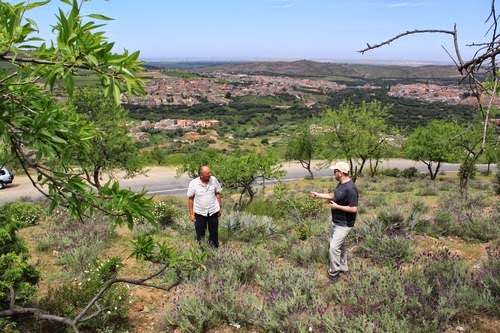
Millington, J.D.A., Demeritt, D. and Romero-Calcerrada, R. (2011) Participatory evaluation of agent-based land use models Journal of Land Use Science 6(2-3) 195-210 doi:10.1080/1747423X.2011.558595

Millington, J.D.A. et al. (2011) Combined long-term effects of variable tree regeneration and timber management on forest songbirds and timber production Forest Ecology and Management 262 718-729
Abstract
The structure of forest stands is an important determinant of habitat use by songbirds, including species of conservation concern. In this paper, we investigate the combined long-term impacts of variable tree regeneration and timber management on stand structure, songbird occupancy probabilities, and timber production in northern hardwood forests. We develop species-specific relationships between bird species occupancy and forest stand structure for canopy-dependent black-throated green warbler (Dendroica virens), eastern wood-pewee (Contopus virens), least flycatcher (Empidonax minimus) and rose-breasted grosbeak (Pheucticus ludovicianus) from field data collected in northern hardwood forests of Michigan’s Upper Peninsula. We integrate these bird-forest structure relationships with a forest simulation model that couples a forest-gap tree regeneration submodel developed from our field data with the US Forest Service Forest Vegetation Simulator (Ontario variant). Our bird occupancy models are better than null models for all species, and indicate species-specific responses to management-related forest structure variables. When simulated over a century, higher overall tree regeneration densities and greater proportions of commercially high value, deer browse-preferred, canopy tree Acer saccharum (sugar maple) than low-value, browse-avoided subcanopy tree Ostrya virginiana (ironwood) ensure conditions allowing larger harvests of merchantable timber and had greater impacts on bird occupancy probability change. Compared to full regeneration, no regeneration over 100 years reduces merchantable timber volumes by up to 25% and drives differences in bird occupancy probability change of up to 30%. We also find that harvest prescriptions can be tailored to affect both timber removal volumes and bird occupancy probability simultaneously, but only when regeneration is adequate. When regeneration is poor (e.g., 25% or less of trees succeed in regenerating), timber harvest prescriptions have a greater relative influence on bird species occupancy probabilities than on the volume of merchantable timber harvested. However, regeneration density and composition, particularly the density of Acer saccharum regenerating, have the greatest long-term effects on canopy bird occupancy probability. Our results imply that forest and wildlife managers need to work together to ensure tree regeneration density and composition are adequate for both timber production and the maintenance of habitat for avian species over the long-term. Where tree regeneration is currently poor (e.g., due to deer herbivory), forest and wildlife managers should pay particularly close attention to the long-term impacts of timber harvest prescriptions on bird species.

Millington, J.D.A. and Perry, G.L.W. (2011) Multi-model inference in biogeography Geography Compass 5(7) 448-530
Abstract
Multi-model inference (MMI) aims to contribute to the production of scientific knowledge by simultaneously comparing the evidence data provide for multiple hypotheses, each represented as a model. With roots in the method of ‘multiple working hypotheses’, MMI techniques have been advocated as an alternative to null-hypothesis significance testing. In this paper, we review two complementary MMI techniques – model selection and model averaging – and highlight examples of their use by biogeographers. Model selection provides a means to simultaneously compare multiple models to evaluate how well each is supported by data, and potentially to identify the best supported model(s). When model selection indicates no clear ‘best’ model, model averaging is useful to account for parameter uncertainty. Both techniques can be implemented in information-theoretic and Bayesian frameworks and we outline the debate about interpretations of the different approaches. We summarise recommendations for avoiding philosophical and methodological pitfalls, and suggest when each technique is best used. We advocate a pragmatic approach to MMI, one that emphasises the ‘thoughtful, science-based, a priori’ modelling that others have argued is vital to ensure valid scientific inference.

Millington et al. (2011) Participatory evaluation of agent-based land use models Journal of Land Use Science 6(2-3) 195-210
Abstract
A key issue facing contemporary agent-based land-use models (ABLUMs) is model evaluation. In this article, we outline some of the epistemological problems facing the evaluation of ABLUMs, including the definition of boundaries for modelling open systems. In light of these issues and given the characteristics of ABLUMs, participatory model evaluation by local stakeholders may be a preferable avenue to pursue. We present a case study of participatory model evaluation for an agent-based model designed to examine the impacts of land-use/cover change on wildfire regimes for a region of Spain. Although model output was endorsed by interviewees as credible, several alterations to model structure were suggested. Of broader interest, we found that some interviewees conflated model structure with scenario boundary conditions. If an interactive participatory modelling approach is not possible, an emphasis on ensuring that stakeholders understand the distinction between model structure and scenario boundary conditions will be particularly important.

Landscape time-lapse

My blogging’s been quite dry recently. So here’s something more fun. If you like landscape photography, you’ll love this video (expand to fullscreen if you can):

http://vimeo.com/moogaloop.swf?clip_id=10655199&server=vimeo.com&show_title=1&show_byline=1&show_portrait=0&color=&fullscreen=1

Stomacher – Untitled/Dark Divider from Sean Stiegemeier on Vimeo.

There’s some more by the same guy here, and an awesome one of the recent Icelandic volcanic eruptions here.

‘Mind, the Gap’ paper in press

I hoped it would be quicker than previous papers, but the review process of the ‘Mind, the Gap’ manuscript I worked on with John Wainwright hasn’t been particularly fast. I guess that’s just how it goes with special issues. I’ll discuss some of the topics we touch on in the paper in a future post. For now here’s the abstract – look out for the full paper on the ESPL website in the next couple of months.

Mind, the Gap in Landscape-Evolution Modelling
John Wainwright and James Millington
Earth Surface Processes and Landforms (Forthcoming)

Abstract
Despite an increasing recognition that human activity is currently the dominant force modifying geomorphic landscapes, and that this activity has been increasing through the Holocene, there has been little integrative work to evaluate human interactions with geomorphic processes. We argue that agent-based models (ABMs) are a useful tool for overcoming the limitations of existing, highly empirical approaches. In particular, they allow the integration of decision-making into process-based models and provide a heuristic way of evaluating the compatibility of knowledge gained from a wide range of sources, both within and outwith the discipline of geomorphology. The application of ABMs to geomorphology is demonstrated from two different perspectives. The SPASIMv1 (Special Protection Area SIMulator version 1) model is used to evaluate the potential impacts of land-use change – particularly in relation to wildfire and subsequent soil conditions – over a decadal timescale from the present day to the mid-21st century. It focuses on the representation of farmers with traditional versus commercial perspectives in central Spain, and highlights the importance of land-tenure structure and historical contingencies of individuals’ decision making. CYBEROSION, on the other hand, considers changes in erosion and deposition over the scale of at least centuries. It represents both wild and domesticated animals and humans as model agents, and investigates the interactions of them in the context of early agriculturalists in southern France in a prehistoric context. We evaluate the advantages and disadvantages of the ABM approach, and consider some of the major challenges. These challenges include potential process scale mis-matches, differences in perspective between investigators from different disciplines, and issues regarding model evaluation, analysis and interpretation. If the challenges can be overcome, this fully-integrated approach will provide geomorphology a means to conceptualize soundly the study of human-landscape interactions.

Plant Now and Use Sustainably

In the climate change debate there’s been a lot of talk about current Amazonian rainforest deforestation, but I’ve heard much less about the role of the UK’s forests for carbon sequestration. Given the relative size of the UK to the Amazonian rainforest that’s not so surprising – The Nature Conservancy suggests the area of rainforest cut down each year (20 million hectares) is the same as the combined area of England, Scotland and Wales. The estimated 5000 years it took [.pdf] to go from 75% of the UK covered by forests and woodlands to the current 12% just doesn’t compare.


Recently, however, the case been made for increasing UK forest and woodland cover as a form of climate change mitigation. This summer the UK Low Carbon Transition Plan identified woodland creation as a cost-effective way of mitigating climate change and recognised the importance of supporting tree-planting initiatives. More recently, the National Assessment of UK Forestry and Climate Change Steering Group has provided its response to the IPCC Fourth Assessment Report and argues there is a clear need for more woodlands.


One of the main findings of this initial assessment was that an increase in woodland area of 23,000 ha per year over the next 40 years could abate 10% of UK 2050 greenhouse gas emissions. With echos of the recommendation from the Stern Review on the Economics of Climate Change to ‘Act now or pay later’, the key message from this assessment is ‘Plant now and use sustainably’. The long maturation times of forest systems means that it may take take 50–100 years for actions to pay off.

Being such a long-standing investment it’s vital that the benefits of planted woodlands and forests are not outweighed by negative impacts on biodiversity, food security, landscape and water supply. From this stand-point there is much to be done and the assessment recommends that “further scientific and socio-economic analysis is required to enable the UK to achieve the full [climate] adaptation and mitigation potential of forestry” and that “clear, robust, research programmes will be needed to underpin the changes of forestry policy and practice which are required to meet the new and challenging circumstances”.

A question that immediately springs to my mind is where these woodlands should be placed to maximise their carbon sequestration payoff while minimising negative impacts on other aspects of the landscape. For example, if arable agricultural land is to be converted, how will biodiversity be affected by the removal of hedgerows? What would this conversion of agricultural land mean for local economies? Which species will benefit in terms of habitat connectivity and which will lose out? Addressing questions like these will be important as forest policy moves toward returning UK forest cover area near levels seen elsewhere in Europe.

Conference Deadlines

Those interested in landscape modelling might want to be aware of the deadlines for LANDMOD 2010 and US-IALE 2010.

LANDMOD 2010
LANDMOD 2010 will be held at SupAgro in Montpellier, France, February 3rd to 5th 2010.

The 2010 international conference on integrative landscape modelling will gather leading scientists in each of the main disciplines dealing with ecosystems and landscape simulation and management, complex dynamic modelling and assessment of vulnerability, resilience and adaptation of agro- and eco-systems under human influence.

The main objectives of the conference are:

  • To discuss the objectives, priorities and expectations when modelling the functioning of landscapes;
  • To share experience about landscape modelling and to identify major existing conceptual and technological gaps;
  • To release a ‘state of the art’ about landscape modelling and simulation;
  • To start building an international network on integrative ecosystems and landscape modelling.

Deadlines
October 31st : deadline for submission of extended abstracts
November, 30th: notification of acceptation of talks and posters
December, 31st : deadline for registration and payment

Website: http://www.umr-lisah.fr/rtra-projects/landmod2010

US-IALE 2010
The 25th annual meeting of US-IALE (US Regional Association, International Association for Landscape Ecology) will be held in Athens, Georgia, from April 5-9, 2010. One of the unique aspects of the 25th annual meeting is to reflect upon progress made in the past 25 years and to chart an even more productive course for landscape ecology over the next quarter century. The meeting will include special sessions at which past presidents of US-IALE and other leading landscape ecologists will provide retrospectives on and perspectives for landscape ecology.

Approximately 20 NASA-MSU Awards and 10 CHANS Fellowships will be available to support students, postdoctoral associates, junior faculty and other junior researchers to attend the meeting.

Deadlines
October 15, 2009: Proposals for symposia and workshops
December 15, 2009: Abstracts for oral and poster presentations
December 15, 2009: NASA-MSU Awards Applications
December 15, 2009: CHANS Fellowship Applications

Website: http://www.usiale.org/athens2010/