PhD pass!

After a gruelling three-and-a-half hour examination yesterday, my examiners Prof. Keith Richards and Prof. Eric Lambin are satisfied that I should be awarded the degree of PhD, subject to three minor amendments!

Thanks to everyone that helped me celebrate in London last night. Also, thanks to all those that helped me along the way on my PhD journey: George, Raul, David, John, David, Bruce, Shatish, Margaret, Rob, Alison, Isobel, Erin, Kat, Andreas, Ben, Chris, Gareth, Isobel, Helen, Nick, Pete, Chris, Mark, Laura, Jamie, Helen, Neil, Nicky, Javier, Livs, Mum, Dad, Michael and Mark… and anyone else I’ve forgotten! Stay in touch everyone.

I’m off across the pond to start my postdoc at MSU tomorrow. Eight great years in London at King’s over, hopefully many more to come elsewhere…

Agent-Based Modelling for Interdisciplinary Geographical Enquiry

Bruce Rhoads argued that;

“The time has come for geography to fulfil its potential by adopting a position of intellectual leadership in the realm of interconnections between human and biophysical systems.”

Many areas of scientific endeavour are currently attempting to do the same and interdisciplinarity has become a big buzzword. Modelling has become a common tool for this interdisciplinary study (for example ecological-economic models), with several different approaches available. Increases in computing power and the arrival of object-oriented programming have led to the rise of agent-based modelling (also termed individual-based and discrete element).

In their latest paper in Geoforum, Bithell et al. propose this form of modelling, with its “rich diversity of approaches”, as an opportune way to explore the interactions of social and environmental processes in Geography. The authors illustrate the potential of this form of modelling by providing outlines of individual-based models from hydrology, geomorphology, ecology and land-use change (the latter of which I have tried to turn my hand to). The advantages of agent-based modelling, the authors suggest, include the ability to represent

  1. agents as embedded within their environment,
  2. agents as able to perceive both their internal state and the state of their environment
  3. agents that may interact with one another in a non-homogeneous manner
  4. agents that can take action to change both their relationships with other agents and their environment
  5. agents that can retain a ‘memory’ of a history of past events.

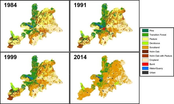
However the development of these representation can be a challenging task as I found during my PhD modelling exploits, and requires a ‘diversity of resources’. When representing human agents these resources include past population censuses, surveys and interviews of contemporary populations, and theoretical understanding of social, cultural and economic behaviour from the literature. In my modelling of a contemporary population I used interviews and theoretical understanding from the literature and found that, whilst more resource intensive, actually going to speak with those being represented in the model was by far more useful (and actually revealed the deficiencies of accepted theories).

In their discussion, Bithell et al. consider the problems of representing social structures within and an individual-based model suggesting that;

“simulation of social structure may be a case of equipping model agents with the right set of tools to allow perception of, and interaction with, dynamic structures both social and environmental at scales much larger than individual agents”.

Thus, the suggestion is that individually-based models of this type may need some form of hierarchical representation.

Importantly I think, the authors also briefly highlight the reflexive nature of agent-based models of human populations. This reflexivity occurs of the model is embedded within the society which it represents, thus potentially modifying the structure of system it represents. This situation has parallels with Hacking’s ‘looping effect’ that I’ll write about more another time. Bithell et al. suggest that this reflexive nature may, in the end, limit the questions that such models can hope meaningfully address. However, this does not prevent them from concluding;

“The complex intertwined networks of physical, ecological and social systems that govern human attachment to, and exploitation of, particular places (including, perhaps, the Earth itself) may seem an intractable problem to study, but these methods have the potential to throw some light on the obscurity; and, indeed, to permit geographers to renew their exploration of space–time geographies.”

The Importance of Land Tenure

The Economist today highlighted some recent work by Dr Thomas Elmqvist of Stockholm University. Using a combination of Landsat satellite imagery and interviews and surveys with locals in Madagascar, they examined whether human population densities or land tenure systems were more important for determining patters of tropical deforestation.

“From the Landsat images they were able to distinguish areas of forest loss, forest gain and stable cover. Different parts of Androy exhibited different patterns. The west showed a continuous loss. The north showed continuous increase. The centre and the south appeared stable. Damagingly for the population-density theory, the western part of the region, the one area of serious deforestation, had a low population density.

This is not to say that a thin population is bad for forests; the north, where forest cover is increasing, is also sparsely populated. But what is clear is that lots of people do not necessarily harm the forest, since cover was stable in the most highly populated area, the south.

The difference between the two sparsely populated regions was that in the west, where forest cover has dwindled, neither formal nor customary tenure was enforced. In the north—only about 20km away—land rights were well defined and forest cover increased. As with ocean fisheries, so with tropical forests, everybody’s business is nobody’s business.”

Land tenure (spatial) structure was one of the variables I examined in my agent-based model of agricultural land-use decision-making in Spain. I found that whilst the neighbourhood effects were evident in patterns of land-use due to land tenure, market conditions were the primary driver of change (NB land-use/cover change in the traditional Mediterranean landscape I examined is of a markedly different type).

Ecological and economic models for biodiversity conservation

As a follow-up to yesterday’s post, the latest volume of Ecological Economics has a paper by Drechsler et al. entitled, ‘Differences and similarities between ecological and economic models for biodiversity conservation’. They compare 60 ecological and economic models and suggest:

“Since models are a common tool of research in economics and ecology, it is often implicitly assumed that they can easily be combined. By making the differences between economic and ecological models explicit we hope to have helped to avoid miscommunication that may arise if economists and ecologists talk about “models” and believe they mean the same but in fact think of something different. The question that arises from the analysis of this paper is, of course: What are the reasons for the differences between economic and ecological models?”

The authors suggest five possible routes into the examination of this question:

  1. Different disciplinary traditions
  2. Differences in the systems analysed
  3. Differences in the perception of the system analysed
  4. Varying personal preferences of researchers
  5. Models serve different purposes

Drechsler et al. conclude:

“The general lesson from this is that economists who start thinking about developing ecological–economic models have to be prepared that they might be involved in complex modelling not typical and possibly less respected in economics. On the other hand, ecologists starting collaborations with modellers from economics have to be aware that in economics analytical tractability is much higher valued and simple models are more dominant than in ecology.”

Integrating Ecology and Economics

With my viva voce just over two weeks ago I really should be concentrating all my efforts on ensuring that I’m adequately prepared for the oral defence of my PhD thesis. I’m doing OK, but I’m a little distracted by my impending move to the Center for Systems Integration and Sustainability at Michigan State University. There I’ll be working on a project that will take a systems approach to develop an integrated ecological-economic model for the management of a forest landscape in Michigan’s Upper Peninsula.

I touched on some of the difficulties of integrated ecological-economic modelling in my thesis:

The difficulties of integrating ecological and economic theory into a model or framework for study have been outlined by Svedin and Bockstael et al.. These authors highlight some common points regarding time and space scales. First, the spatial boundaries on systems’ analysis may not coincide, as economists place their boundaries according to the extent of the market, whilst ecologists typically use physical features. Second, the temporal extents of study may differ vastly as economists do not believe they can predict too far into the future, but ecologists are often more ambitious. Potentially the biggest stumbling block for integrating economic and ecological approaches however, is the difference in the disciplines’ fundamental approach and philosophy. First, economists disregard things that they cannot value financially but ecologists believe that a theoretical framework must take account of the most important aspects of a problem (regardless of financial value – Bockstael et al.). As ecosystem processes are very difficult (if not impossible) to value in financial terms, these two standpoints are hard to reconcile. These differences in approach, and the difference in the systems of study, result in different “units of measurement, populations of interest, handling of risk and uncertainty and paradigms of analysis” when modelling (Bockstael et al. p.146). Svedin discusses the potential of using energy or information as fundamental units that might be used in common by the two disciplines. However, Bockstael et al. point out that reducing systems to the lowest possible common denominator has often simply resulted in larger black box models, compromising individual model modules’ integrity. Svedin possibly realised this when he concluded that integration should be context-dependent for the study at hand, and that the underlying philosophies of different disciplines must be remembered when attempting integration.

One method that has been developed to address these issues is economic valuation of ecosystem services. A recent example of this sort of exercise was undertaken for the trees of New York City. Designed for use in urban areas, the USFS Stratum model uses a tree growth model coupled with data on the regional climate, building construction and energy use patterns, fuel mix for energy production, and air pollutant concentrations to estimate environmental benefits and costs as well as effects on property values. Alongside the economic value of the trees (the annual monetary value of the benefits provided and costs accrued), Stratum estimates the resource’s structure (species composition, extent and diversity), function (the environmental & aesthetic benefits trees afford the community), and resource management needs (evaluations of diversity, canopy cover, and pruning needs). According to Stratum the nearly 600,000 trees lining the streets of New York City are worth $122 million – and this doesn’t include the 4.5 million trees in parks and on private land.

As the outputs of Stratum suggest, there are both monetary and non-monetary forms of ecosystem valuation, both with pros and cons. One notable form of monetary ecosystem valuation is non-market valuation. Non-market valuation attempts to estimate the value of goods and services that do not have observable market values. In the forthcoming project at CSIS we hope to use non-market valuation as a complementary approach to more traditional market valuation analysis to better examine economic trade-offs between various ecosystem services and ensure the development of sustainable management plans. In developing the model in this way we will be exploring ways to overcome the fundamental differences between economic and ecological theory.

Reference
Svedin, U. (1985) Economic and ecological theory: differences and similarities In: Hall, D. O., Myers, N. and Margaris, N. S. Economics of ecosystems management:31-39 Dordrecht: Dr W. Junk Publishers

EGU 2007 Poster

I’m not attending the European Geophysics Union General Assembly this year as I have done the past couple. However, I do have a poster there (today, thanks to Bruce Malamud for posting it) on some work I have been doing with Raul Romero Calcerrada at Universidad Rey Juan Carlos in Madrid, Spain. We have been using various spatial statistical modelling techniques to examine the spatial patterns and causes (including both socioeconomic and biophysical) of wildfire ignition probabilities in central Spain. The poster abstract is presented below and we’re working on writing a couple of papers related to this right now.

Spatial analysis of patterns and causes of fire ignition probabilities using Logistic Regression and Weights-of-Evidence based GIS modelling
R. Romero-Calcerrada, J.D.A. Millington
In countries where more than 95% of wildfires are caused by direct or indirect human activity, such as those in the Iberian Peninsula, ignition risk estimation must consider anthropic influences. However, the importance of human factors has been given scant regard when compared to biophysical factors (topography, vegetation and meteorology) in quantitative analyses of risk. This disregard for the primary cause of wildfires in the Iberian Peninsula is owed to the difficulties in evaluating, modelling and representing spatially the human component of both fire ignition and spread. We use logistic regression and weights-of-evidence based GIS modelling to examine the relative influence of biophysical and socio-economic variables on the spatial distribution of wildfire ignition risk for a six year time series of 508 fires in the south west of the Autonomous Community of Madrid, Spain. We find that socioeconomic variables are more important than biophysical to understand spatial wildfire ignition risk, and that models using socioeconomic data have a greater accuracy than those using biophysical data alone. Our findings suggest the importance of socioeconomic variables for the explanation and prediction of the spatial distribution of wildfire ignition risk in the study area. Socioeconomic variables need to be included in models of wildfire ignition risk in the Mediterranean and will likely be very important in wildfire prevention and planning in this region.

PhD Thesis Completed

So, finally, it is done. As I write, three copies of my PhD Thesis are being bound ready for submission tomorrow! I’ve posted a short abstract below. If you want a more complete picture of what I’ve done you can look at the Table of Contents and read the online versions of the Introduction and Discussion and Conclusions. Email me if you want a copy of the whole thesis (all 81,000 words, 277 pages of it).

So just the small matter of defending the thesis at my viva voce in May. But before that I think it’s time for a celebratory beer on the South Bank of the Thames in the evening sunshine…

Modelling Land-Use/Cover Change and Wildfire Regimes in a Mediterranean Landscape

James D.A. Millington
March 2007

Department of Geography
King’s College, London

Abstract
This interdisciplinary thesis examines the potential impacts of human land-use/cover change upon wildfire regimes in a Mediterranean landscape using empirical and simulation models that consider both social and ecological processes and phenomena. Such an examination is pertinent given contemporary agricultural land-use decline in some areas of the northern Mediterranean Basin due to social and economic trends, and the ecological uncertainties in the consequent feedbacks between landscape-level patterns and processes of vegetation- and wildfire-dynamics.

The shortcomings of empirical modelling of these processes are highlighted, leading to the development of an integrated socio-ecological simulation model (SESM). A grid-based landscape fire succession model is integrated with an agent-based model of agricultural land-use decision-making. The agent-based component considers non-economic alongside economic influences on actors’ land-use decision-making. The explicit representation of human influence on wildfire frequency and ignition in the model is a novel approach and highlights biases in the areas of land-covers burned according to ignition cause. Model results suggest if agricultural change (i.e. abandonment) continues as it has recently, the risk of large wildfires will increase and greater total area will be burned.

The epistemological problems of representation encountered when attempting to simulate ‘open’, middle numbered systems – as is the case for many ‘real world’ geographical and ecological systems – are discussed. Consequently, and in light of recent calls for increased engagement between science and the public, a shift in emphasis is suggested for SESMs away from establishing the truth of a model’s structure via the mimetic accuracy of its results and toward ensuring trust in a model’s results via practical adequacy. A ‘stakeholder model evaluation’ exercise is undertaken to examine this contention and to evaluate, with the intent of improving, the SESM developed in this thesis. A narrative approach is then adopted to reflect on what has been learnt.

Logistic Regression for LUCC Modelling

This post is my third contribution to JustScience week.

In Land Use/Cover Change (LUCC) studies, empirical (statistical) models use the observed relationship between independent variables (for example mean annual temperature, human population density) and a dependent variable (for example land-cover type) to predict the future state of that dependent variable. The primary limitation of this approach is the inability to represent systems that are non-stationary.

Non-stationary systems are those in which the relationships between variables are changing through time. The assumption of stationarity rarely holds in landscape studies – both biophysical (e.g. climate change) and socio-economic driving forces (e.g. agricultural subsidies) are open to change. Two primary empirical models are available for studying lands cover and use change; transition matrix (Markov) models and regression models. My research has particularly focused on the latter, particularly the logistic regression model.


Figure 1.

Figure 1 above shows observed land cover for 3 years (1984 – 1999) for SPA 56, with a fourth map (2014) predicted from this data. Models run for observed periods of change for SPA 56 were found to have a pixel-by-pixel accuracy of up to 57%. That is, only just over half of the map was correctly predicted. Not so good really…

Pontius and colleagues have bemoaned such poor performance of models of this type, highlighting that models are often unable to perform even as well as the ‘null model of no change’. That is, assuming the landscape does not change from one point in time to another is often a better predictor of the landscape (at the second point in time) than a regression model! Clearly, maps of future land cover from these models should be understood as a projection of future land cover given observed trends continue unchanged into the future (i.e. the stationarity condition is maintained).

Acknowledgement of the stationarity assumption is perhaps more important, and more likely to be invalid, from a socio-economic perspective than biophysical. Whilst biophysical processes might be assumed to be relatively constant over decadal timescales (climatic change aside), this will likely not be the case for many socio-economic processes. With regard to SPA 56 for example, the recent expansion of the European Union to 25 countries, and the consequent likely restructuring of the Common Agricultural Policy (CAP), will lead to shifts in the political and economic forces driving LUCC in the region. The implication is that where socio-economic factors are important contributors to landscape change regression models are unlikely to be very useful for predicting future landscapes and making subsequent ecological interpretation or management decisions.

Because of the shortcomings of this type of model, alternative methods to better understanding processes of change, and likely future landscape states, will be useful. For example, hierarchical partitioning is a method for using statistical modelling in an explanatory capacity rather than for predictive purposes. Work I did on this with colleagues was recently accepted for publication by Ecosystems and I’ll discuss it in more detail tomorrow. The main thrust of my PhD however, is the development of an integrated socio-ecological simulation model that considers agricultural decision-making, vegetation dynamics and wildfire regimes.

Technorati Tag: , , ,

Characterizing wildfire regimes in the United States

This post is my second contribution to JustScience week, and follows on from the first post yesterday.

During my Master’s Thesis I worked with Dr. Bruce Malamud to examine wildfire frequency-area statistics and their ecological and anthropogenic drivers. Work resulting from this thesis led to the publication of Malamud et al. 2005

We examined wildfires statistics for the conterminous United States (U.S.) in a spatially and temporally explicit manner. Using a high-resolution data set of 88,916 U.S. Department of Agriculture Forest Service wildfires over the time period 1970-2000 to consider wildfire occurrence as a function of biophysical landscape characteristics. We used Bailey’s ecoregions as shown by Figure 1A below.

Figure 1.

In Bailey’s classification, the conterminous U.S. is divided into ecoregion divisions according to common characteristics of climate, vegetation, and soils. Mountainous areas within specific divisions are also classified. In the paper, we used ecoregion divisions to geographically subdivide the wildfire database for statistical analyses as a function of ecoregion division. Figure 1B above shows the location of USFS lands in the conterminous U.S.

We found that wildfires exhibit robust frequency-area power-law behaviour in the 18 different ecoregions and used power-law exponents (normalized by ecoregion area and the temporal extent of the wildfire database) to compare the scaling of wildfire-burned areas between ecoregions. Normalizing the relationships allowed us to map the frequency-area relationships, as shown in Figure 2A below.

Figure 2.

This mapping exercise shows a systematic change east-to-west gradient in power-law exponent beta values. This gradient suggests that the ratio of the number of large to small wildfires decreases from east to west across the conterminous U.S. Controls on the wildfire regime (for example, climate and fuels) vary temporally, spatially, and at different scales, so it is difficult to attribute specific causes to this east-to-west gradient. We suggested that the reduced contribution of large wildfires to total burned area in eastern ecoregion divisions might be due to greater human population densities that have increased forest fragmentation compared with western ecoregions. Alternatively, the gradient may have natural drivers, with climate and vegetation producing conditions more conducive to large wildfires in some ecoregions compared with others.

Finally, this method allowed us to calculate recurrence intervals for wildfires of a given burned area or larger for each ecoregion (Figure 2B above). In turn this allowed for the classification of wildfire regimes for probabilistic hazard estimation in the same vein as is now used for earthquakes.

Read the full paper here.

Technorati Tags: , , , ,

Wildfire Frequency-Area Scaling Relationships

This post is the first of my contribution to JustScience week.

Wildfire is considered an integral component of ecosystem functioning, but often comes into conflict with human interests. Thus, understanding and managing relationship between wildfire, ecology and human activity is of particular interest to both ecologists and wildfire managers. Quantifying the wildfire regime is useful in this regard. The wildfire regime is the name given to the combination of the timing, frequency and magnitude of all fires in a region. The relationship between the frequency and magnitude of fires, the frequency-area distribution, is one particular aspect of the wildfire regime that has become of interest recently.

Malamud et al. 1998 examined ‘Forest Fire Cellular Automata‘ finding a power-law relationship between the frequency and size of events. The power-law relationship takes the form:

power-law function

where frequency is the frequency of fires with size area, and beta is a constant. beta is a measure of the ratio of small to medium to large size fires and how frequently they occur. The smaller the value of beta, the greater the contribution of large fires (compared to smaller fires) to the total burned area of a region. The greater the value, the smaller the contribution. Such a power-law relation is represented on a log-log plot as straight line, as the example from Malamud et al. 2005 shows:

power-law distribution

Shown circles are number of wildfires per “unit bin” of 1 km^2 (in this case normalized by database length in years and area in km^2) plotted as a function of wildfire area. Also shown is a solid line (best least-squares fit) with coefficient of determination r^2. Dashed lines represent lower/upper 95% confidence intervals, calculated from the standard error. Horizontal error bars on burned area are due to measurement and size binning of individual wildfires. Vertical error bars represent two standard deviations of the normalized frequency densities and are approximately the same as the lower and upper 95% confidence interval.

As a result of their work on the forest fire cellular automata Malamud et al. 1998 wondered whether the same relation would hold for empirical wildfire data. They found the power-law relationship did indeed hold for observed wildfire data for parts of the US and Australia. As Millington et al. 2006 discuss, since this seminal publication several other studies have suggested a power-law relationship is the best descriptor of the frequency-size distribution of wildfires around the world.

During my Master’s Thesis I worked with Dr. Bruce Malamud to examine wildfire frequency-area statistics and their ecological and anthropogenic drivers. Work resulting from this thesis led to the publication of Malamud et al. 2005 which I’ll discuss in more detail tomorrow.

Technorati Tags: , , ,