Michigan UP Deer Distribution Fieldwork

I’m back in the UP for more fieldwork. Last time I was up here was right before the start of hunting season last year. Since then a hard winter has passed and is now just being replaced by spring. There’s still snow on the ground in the northern areas of our study area, but it’s melting fast. Over the next couple of weeks we’ll be doing deer pellet counts (as a proxy for numbers of deer) to supplement previous data and to try to get a better gauge on how snowfall affects the spatial distribution of deer during the winter. We need to do these as soon after the snow melts before ground level vegetation re-grows and obscures the pellets. We’re also going to count pellets in the stands where we planted tree seedlings last fall. Then we’ll compare the estimated deer numbers in the stands with the browse on the seedlings we planted (if there’s anything left of them at all!) to try to get a more precise handle on how deer density relates to browse impact of different species.

So that’s my next few weeks – counting deer poo in the UP forests. I doubt I’ll be online much so this might be the last blog for a week or two. I’ll take some photos and maybe post them when I’m back in Lansing.

US-IALE 2008 – Summary


A brief and belated summary of the 23rd annual US-IALE symposium in Madison, Wisconsin.

The theme of the meeting was the understanding of patterns, causes, and consequences of spatial heterogeneity for ecosystem function. The three keynote lectures were given by Gary Lovett, Kimberly With and John Foley. I found John Foley’s lecture the most interesting and enjoyable of the three – he’s a great speaker and spoke on a broader topic than the the others; Agriculture, Land Use and the Changing Biosphere. Real wide-ranging, global sustainability stuff. He highlighted the difficulties of studying agricultural landscapes because of the human cultural and institutional factors, but also stressed the importance of tackling these tricky issues because ‘agriculture is the largest disturbance the biosphere has ever seen’ and because of its large contribution to greenhouse gas emissions.

Presentations I was particularly interested in were mainly in the ‘Landscape Patterns and Ecosystem Processes: The Role of Human Societies’, ‘Challenges in Modeling Forest Landscapes under Climate Change’ and ‘Cross-boundary Challenges to the Creation of Multifunctional Agricultural Landscapes’ sessions.

In the ‘human societies’ session, Richard Aspinall discussed the importance of considering human decision-making at a range of scales and Dan Brown again highlighted the importance of human agency in spatial landscape process models. In particular, with regards modelling these systems using agent-based approaches he discussed the difficulty of model calibration at the agent level and stressed that work is still needed on the justification and evaluation phases of agent-based modelling.

The ‘modeling forest landscapes’ session was focused largely around use of the LANDIS and HARVEST models that were developed in and around Wisconsin. In fact, I don’t think I saw any mention of the USFS FVS at the meeting whilst I was there, largely because (I think) FVS has large data demands and is not inherently spatial. LANDIS and HARVEST work at more coarse levels of forest representation (grid cell compared to FVS’ individual tree) allowing them to be spatially explicit and to run over large time and space extents. We’re confident we’ll be able to use FVS in a spatially explicit manner for our study area though, capitalising on the ability of FVS to directly simulate specific timber harvest and economic scenarios.

The ‘multifunctional agricultural landscapes’ session had an interesting talk by Joan Nassauer on stakeholder science and the challenges it presents. Specific issues she highlighted were:
1. the need for a precise, operational definition of ‘stakeholder’
2. ambiguous goals for the use of stakeholders
3. the lack of a canon of replicable methods
4. ambivalence toward the quantification of stakeholder results

Other interesting presentations were given by Richards Hobbs and Carys Swanwick. Richard spoke about the difficulties of ‘integrated research’ and the importance of science and policy in natural resource management. He suggested that policy-makers ‘don’t get’ systems thinking or modelling, and that some of this may be down to the psychological profiles of the types of people that go into policy making. Such a conclusion suggests scientists need to work harder to bridge the gap to policy makers and do a better job of explaining the emergent properties of the complex systems they study. Carys Swanwick talked about the landscape character assessment, which was interesting for me having moved from the UK to the US about a year ago. Whilst ‘wilderness’ is an almost alien concept in the UK (and Europe as a whole), landscape character is something that is distinctly absent in the new world agricultural landscapes. Carys talked about the use of landscape character as a tool for conservation and management (in Europe) and the European Landscape Convention. It was a refreshing change from many of the other presentations about agricultural landscape (possibly just because I enjoyed seeing a few pictures of Blighty!).

Unfortunately the weather during the conference was wet which meant that I didn’t get out to see as much of Madison as I would have liked. Despite the rain we did go on the Biking Fieldtrip. And yes, we did get soaked. It was also pretty miserable weather for the other fieldtrip to and International Crane Foundation center and the Aldo Leopold Foundation (more on that in a future blog), but interesting nevertheless.

Other highlights of the conference for me were meeting the former members of CSIS and eating dinner one night with Monica Turner. I also got to meet up with Don McKenzie and some of the other ‘fire guys’, and a couple of people from the Great Basin Landscape Ecology lab where I visited previously. And now I’m already looking forward to the meeting next year in Snowbird, Utah (where I enjoyed the snow this winter).

April 2008 Conference Posters


Final preparations are underway for the US-IALE Symposium in Madison, WI, next week. I’ve finished the poster that we’ll be presenting there on the progress we’re making withour ecological-economic forest landscape model. We’ve also been putting the finishing touches on our posters for the wildfire session at EGU in Vienna (which Raul will be attending and presenting our posters at). Links to .pdf versions of the posters are below. Thoughts and photos from Madison and Chicago (where I’ll be stopping off for a couple of days on the way home) on my return.

An Ecological-Economic Model for Sustainable Forest Management: Modeling Deer Distributions from Local & Landscape Characteristics
J.D.A. Millington, J.P. LeBouton, M.B. Walters, K.R. Hall, M.S. Matonis, E.J. Laurent, F. Lupi, S. Chen, J. Liu

An Integrated Socio-Ecological Simulation Model of Succession-Disturbance Dynamics in a Mediterranean Landscape
J.D.A. Millington, J. Wainwright, G.L.W. Perry, R. Romero-Calcerrada, & B.D. Malamud

Spatial modelling of the influence of human activity on wildfire ignition risk in a Mediterranean landscape
R. Romero-Calcerrada, F. Barrio-Parra, J.D.A. Millington, C.J. Novillo

US-IALE 2008 – Landscape Change and other CSIS involvement

Today I started thinking in earnest about the 2008 US-IALE Symposium to be held in Madison, Wisconsin early next month.

I’ll be presenting a poster on our early model development work on the USDA deer/timber regeneration project at CSIS. I will also be chairing the Landscape Change session which has presentations discussing change within and across a diverse range of landscapes including, the Great Plains of the US, the Bolivian Andes and Ukrainian Carpathian mountain ranges, Boreal and Tropical forests, and the Congo Basin.

Whilst in Madison I also plan on attending sessions, symposia, workshops and field-trips devoted to Landscape Patterns and Ecosystem Processes, Modeling Forest Landscapes under Climate Change, Multifunctional Agricultural Landscapes, Forest Landscapes, and Fire. At this last session I’m particularly looking forward to the presentation entitled “Ecological complexity produces simple structure: Power laws in low-severity fire regimes” by Don McKenzie, co-convener of the wildfires session at EGU 2008 the following week (but which I will not be attending).

There will be plenty of other activity by members of CSIS. Jack Liu, president-elect of US-IALE, and CSIS PhD student Vanessa Hull are co-organising the H. Ronald Pulliam Symposium: Sources, Sinks, and Sustainability. Mao-Ning Tuanmu (PhD student) will be making a presentation entitled “Detecting understory vegetation using MODIS data: Implications for giant panda habitat evaluations” in the Remote Sensing session, and Wei Liu (also CSIS PhD student) will present “Conservation success leads to human-wildlife conflicts: Spatial patterns of crop damages and livestock depredation in Wolong Nature Reserve for Giant Pandas, China” in the Social Issues session.

And there’s loads more going on so it promises to be an interesting and busy week! If I get online during a spare 5 minutes I’ll see if I can blog an update on how it’s all going…

Seeing the Wood for the Trees: Pattern-Oriented Modelling

A while back I wrote about the potentially misplaced preoccupation with statistical power in species distribution models. Our attempts at drawing out some relationships between our deer distribution data and descriptors of land cover is proving taxing – the relationships evident at a more coarse spatial resolution (e.g. county level) than we are considering aren’t found in our stand-level data. As a result we moving toward taking a modelling approach that is driven less by our empirical data and more by inferences based on multiple information sources. Particularly I’m drawn toward emphasising an approach I first encountered in my undergraduate landscape ecology class taught by George Perry – ‘Pattern-Oriented Modelling‘.

A prime example of the POM approach is its use to model the spread of rabies through central Europe. The rabies virus has been observed to spread in a wave-like manner, carried by foxes. Grimm et al. (1996) describe how they developed a cellular automate-type model that considers cells (of fox territory) to be in either a healthy, infected or empty state. Through an iterative model development process, their model was gradually refined (i.e. its assumptions and parameters modified) by comparing model results with empirical patterns.

The idea underpinning this iterative POM approach is

“… if we decide to use a pattern for model construction because we believe this pattern contains information about essential structures and processes, we have to provide a model structure which in principle allows the pattern observed to emerge Whether it does emerge depends on the hypotheses we have built into the model.”

This approach has been found particularly useful for the development of ‘bottom-up’ agent-based models. Often understanding of the fine-scale processes driving broad-scale system dynamics and patterns is poor, making it difficult to both structure and parameterise mechanistic models. However, whilst the logical fallacy of affirming the consequent remains, if a model of low-level interactions is able to reproduce higher-level patterns, we can be confident that our model is a better representation of the system mechanics than one that doesn’t. Furthermore, the more patterns at different scales that the model reproduces, the mode confident we can be in it. Thus, in POM

“multiple patterns observed in real systems at different hierarchical levels and scales are used systematically to optimize model complexity and to reduce uncertainty.”Grimm et al. (2005)

Grimm and Berger outline the general protocol of a pattern-oriented modelling approach (whilst reminding us that there is no standard recipe for model development):

  1. Formulate the question or problem
  2. Assemble hypotheses about essential processes and structures
  3. Assemble (observed) patterns
  4. Choose state variables, parameters and structures
  5. Construct the model
  6. Analyse, test and revise the model
  7. Use patterns for parameterisation
  8. Search for independent predictions

Several iterations of this process will be required to refine the model. In initial iterations, steps 2 and 4 may need to be largely inferential if the state of knowledge about the system is poor. However, by moving iteratively back through these steps, and in particular exploiting steps 6 and 7 to inform us about model performance relative to system behaviour, we can improve our knowledge about the system whilst simultaneously ensuring our model recreates observed patterns. For example, during the development of the landscape fire-succession model in my PhD, I compared the landscape-level model results of different sets of (unknown) flammability probabilities (parameters) of each vegetation type required by the model with empirically observed wildfire regime behaviour. By modifying parameters for individual vegetation types I was able to reproduce the appropriate wildfire frequency-area distribution for Mediterranean-type environments that had previously been found (I’m currently writing this up for publications – more soon).

But what does this all have to do with our model of the relationship between deer browse and timber harvest in Michigan’s Upper Pensinsula? Well, right now I think we’re at steps 2,3 and 4 (all at the same time). As our deer and land cover relationships are weak at the stand-level (which is the level we are considering so that we can integrate the model with an economic module), I am currently developing hypotheses (i.e. assumptions) about the structure of the system from previous research on different specific aspects of similar systems. Furthermore, we’re continuing to look for spatial patterns in both vegetation and deer distribution so that we can compare the results of our hypothetical model.

For example, one thing I’m struggling with right now is is how to establish the probability of which individual trees (or saplings) will be removed from a stand due to a given level of deer browse (which in turn is dependent upon a deer density). This is not something that has been explicitly studied (and would be very difficult to study at the landscape level). Therefore we need to parameterise this process in order for the model to function. We should be able to do this by comparing several different parameterisations to empirically observed patterns such as spatial configuration of forest types classified by age class or age/species distributions at the stand-level. That’s the idea anyway – we’ll see how it goes over the next months…

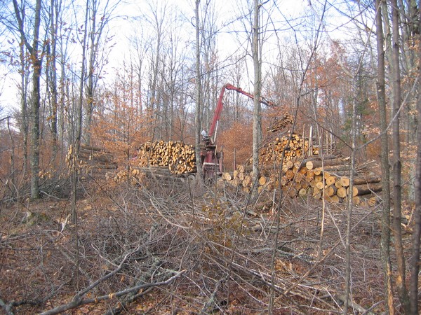
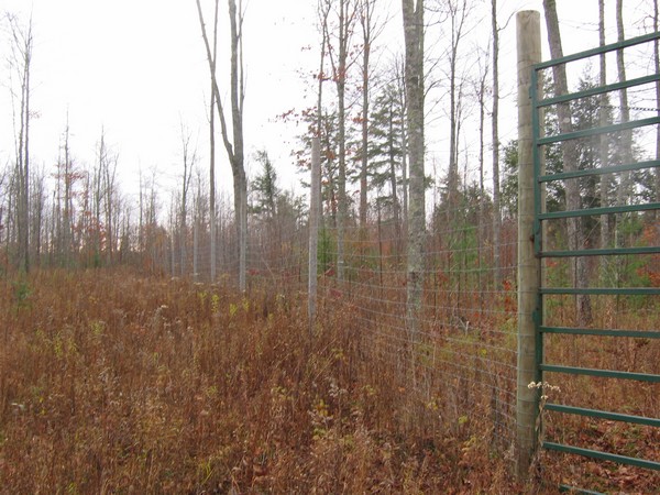
In the meantime, next week I head back to the study area for the first stage of our seedling experiment. We’re planting seedlings now across a gradient of browse and site conditions with the intention of returning in the spring to see what has been browsed and count deer pellets. This should improve our understanding of the link between pellet counts and browse pressure and provide us with some more empirical patterns which we can use in our ongoing model development.

UP Deer Browse Experiment Recce

A few pictures from our trip to the UP study area this past week.

The fall was almost over. We were out on a recce to find sites for an experiment we’re setting up over the next couple of weeks to examine the impact of deer browse on seedlings of various conifer species.

We want to locate our seedling planting on both state and commercial lands – cutting had recently finished at this commercial site.

We also visited a deer exclosure set up to examine tree regeneration in the absence of deer browse (similar in many ways to our experiment). It’s not the best picture, but the effects of 12 years of protection can be seen – very little regeneration on the left of the fence but evidence of green juveniles on the right. These effects haven’t been quantified at this site but by sight alone there’s clearly difference outside s inside the exclosure.

Finally, not all the leaves had fallen. We were a couple of weeks late for the real colours, but some remained down on the Lake Michigan coastline.

The Tyranny of Power?

The past week or two I’ve been wrestling with the data we have on white-tailed deer density and vegetation in Michigan’s Upper Peninsula in an attempt to find some solid statistical relationships that we might use in our ecological-economic simulation model. However, I seem to be encountering similar issues to previous researchers, notably (as Weisberg and Bugmann put it) “the weak signal-to noise ratio that is characteristic of ungulate-vegetation systems”, that “multiple factors need to be considered, if we are to develop a useful, predictive understanding of ungulate-vegetation relationships”, and that “ungulate-vegetation interactions need to be better understood over multiple scales”.

Hobbs suggests that one of the problems slowing species distribution research is a preoccupation with statistical power that he calls “the tyranny of power”. This tyranny arises, he suggests, because traditional statistical methods that are powerful at smaller scales become less useful at larger extents. There are at least three reasons for this including,

  1. small things are more amenable to study by traditional methods than large things
  2. variability increases with scale (extent)
  3. potential for bias increases with scale (extent)

“The implication of the tyranny of power is that many of the traditionally sanctioned techniques for ecological investigation are simply not appropriate at large-scales… This means that inferences at large-scales are likely to require research designs that bear little resemblance to the approaches many of us learned in graduate school.” Hobbs p.230

However, this tyranny may simply be because, as Fortin and Dale point out, “most study areas contain more than one ecological process that can act at different spatial and temporal scales”. That is, the processes are non-stationary in time and space. Leaving time aside for now, spatial non-stationarity has already been found to be present in our study area with regards the processes we’re considering. For example, Shi and colleagues found that Geographically Weighted Regression (GWR) models are better at predicting white-tailed deer densities than an ordinary least-squares regression model for the entirety of our study area.

Hobbs’ argument suggests that it’s often useful analyse ecological data from large regions by partitioning them into smaller, more spatially homogenous areas. The idea is that these smaller patches are more likely to be governed by the same ecological process. But how should these smaller regions be selected? A commonly used geographical division is the ecoregion. Ecoregions divide land into areas of similar characteristics such as climate, soils, vegetation and topography. For our study area we’ve found that relationships between deer densities and predictor variables do indeed vary by Albert’s ecoregions. But we think that there might be more useful ways to divide our study area that take into account variables that are commonly believed to strongly influence spatial deer distributions. In Michigan’s UP the prime example is the large snow fall is received each winter and which hinders deer movement and foraging.

We’re beginning to examine how GWR and spatial boundary analysis might be used to delineate these areas (at different scales) in the hope of refining our understanding about the interaction of deer and vegetation across our large (400,000 ha) landscape. In turn we should be able to better quantify some of these relationships for use in our model.

Fire Danger Very High Across Michigan – Aug 2007

Currently on the MDNR homepage:

“Increasing drought conditions across Michigan have increased the fire danger to very high. Department of Natural Resources wildfire officials are asking outdoor enthusiasts to use caution with outdoor fires.”

Over the weekend erratic winds have fanned a fire to greater than 12,000 acres in the UP, just north of Tahquamenon Falls State Park. More here.

Update – 4th January 2008
On 29th August 2007 Michigan DNR reported the Sleeper Lake fire was 95% contained and at ~18,000 acres was the third largest fire in Michigan history.

Modeling Disturbance Spatially using the FVS

We plan to use the Forest Vegetation Simulator (FVS), developed by the USFS over the previous couple of decades, in our ecological-economic model of a managed forest landscape. This week I’ve been thinking a lot about how best to link a representation of white-tailed deer browse with the FVS.

Two good examples I’ve found of the modelling of forest disturbance using FVS are the Fire and Fuels Extension (FFE) developed at the USFS Rocky Mountain Research Station in collaboration with other parties, and the Westwide Pine Beetle Model developed by the Forest Health Technology Enterprise Team (FHTET).

The Fire and Fuels Extension to the Forest Vegetation Simulator (FFE-FVS) links the existing FVS, models that represent fire and fire-effects, and fuel dynamics and crowning submodels. The overall model is currently calibrated for northern Idaho, western Montana, and northeastern Washington. More details on the FFE-FVS can be found here, where you can also download this video about the extension:


The Westwide Pine Beetle Model simulates impacts of mountain beetle (Dendroctonus ponderosae Hokpins), western pine beetle (D. brevicomis Leconte), and Ips species for which western pines are a host. The model simulates the movement of beetles between the forest stands in the landscape using the Parallel Processor Extension (PPE) to represent multiple forest stands in FVS.

A recent paper by Ager and colleagues in Landscape and Urban Planning presents work that links both the FFE and the WPBM to FVS using the PPE:

We simulated management scenarios with and without thinning over 60 years, coupled with a mountain pine beetle outbreak (at 30 years) to examine how thinning might affect bark beetle impacts, potential fire behavior, and their interactions on a 16,000-ha landscape in northeastern Oregon. We employed the Forest Vegetation Simulator, along with sub-models including the Parallel Processing Extension, Fire and Fuels Extension, and Westwide Pine Beetle Model (WPBM). We also compared responses to treatment scenarios of two bark beetle-caused tree mortality susceptibility rating systems. As hypothesized, thinning treatments led to substantial reduction in potential wildfire severity over time. However, contrary to expectations, the WPBM predicted higher bark beetle-caused mortality from an outbreak in thinned versus unthinned scenarios. Likewise, susceptibility ratings were also higher for thinned stands. Thinning treatments favored retention of early seral species such as ponderosa pine, leading to increases in proportion and average diameter of host trees. Increased surface fuel loadings and incidence of potential crown fire behavior were predicted post-outbreak; however, these effects on potential wildfire behavior were minor relative to effects of thinning. We discuss apparent inconsistencies between simulation outputs and literature, and identify improvements needed in the modeling framework to better address bark beetle-wildfire interactions.

Whilst I’m still in the early stages of working out how our model will all fit together, it seems like an approach that takes a similar approach will be suitable for our purposes. We’ll need to develop a model that is able to represent the spatial distribution of the deer population across the landscape and that can specify the impact of those deer densities on the vegetation for given age-height classes (for each veg species). This model would likely then be linked with FVS via the the PPE. So concurrently over the next few months I’m going to be working on developing a model of deer density and browse impacts, coding this model into a structure that will link with FVS-PPE, and acquiring and developing data for model initialization.

Reference
Ager, A.A., McMahan, A., Hayes, J.L. and Smith, E.L. (2007) Modeling the effects of thinning on bark beetle impacts and wildfire potential in the Blue Mountains of eastern Oregon Landscape and Urban Planning 80:3 p.301-311

Homogenization of the northern U.S. Great Lakes Forests

An email sitting in my inbox this morning directed me toward an article in the latest issue of Landscape Ecology that directly addresses one of the issues I touched on in Saturday’s post; the ‘Maple-ization’ of the western UP Northern Hardwood forests via selective forest harvest and the resulting feedbacks with whitetailed deer populations.

Lisa Schulte and colleagues examined the regional-scale impacts of human land use in the northern U.S. Great Lakes region. They found an overall loss of forestland, lower forest species diversity, functional diversity, and structural complexity compared to pre-Euro-American settlement forests.

Generally, they found evidence of shifts from evergreen conifer (-27.0%) to deciduous hardwood (+22.8%) species between pre-Euro-American settlement and the present time. Specifically, they found marked increases in Aspen (+12.8%) and Maple (+10.1%) and decreases in Pine (-17.5%) and Hemlock (-11.3%) across the area as a whole. However, increases in northern hardwood species were not uniform, and Beech and Birch have decreased (~4% each).


A figure from their paper (above) maps the change in ecoregion characteristics for (A) the extent of open vegetation, (B) dominance of conifers, (C) dominance of aspen (combined Populus tremuloides and P. grandidentata), and (D) dominance of maple (combined Acer saccharum and A. rubrum).

In their discussion the authors (p.1100-01) go on to describe the issues present in our study area;

“Although forests have largely been reestablished across northern portions of the region [following destructive logging in the late 19th century], these forests are on a new trajectory of change rather than recovery toward pre-Euro-American conditions . We attribute lack of recovery to legacies associated with the initial, severe land use conversion, the persistent over-abundance of a keystone herbivore (white-tailed deer), and related management practices that are inattentive to processes that historically promoted vegetation diversity within the region.

The excessive deer abundance at present is a feedback of regional forest management; whitetailed deer at high densities are now regarded as a major threat to forest biodiversity and regeneration in the region and elsewhere (Rooney et al. 2004). The commercial logging that is now the most frequent and widespread forest disturbance across the region largely fails to mimic either the local or landscape effects of the historically prevalent disturbances of windthrow and fire (Mladenoff et al. 1993; Scheller and Mladenoff 2002). Rather, current practices of aspen clearcutting and single-tree selection in maple stands continues to foster this divergence and simplification of the forests by largely favoring their regeneration over a greater diversity of tree species (Crow et al. 2002).”

As I discussed just the other day, we’ll be using the model we’re currently developing to examine spatial scenarios directly related to this issue. For example one aim is to examine scenarios of forest management that allow the recreation of historical herbivore disturbance via spatial patterns of vegetation whilst ensuring the future economic sustainability of the forests.

Reference
Schulte, L.A., Mladenoff, D.J., Crow, T.R., Merrick, L.C., and Cleland, D.T. (2007) Homogenization of northern U.S. Great Lakes forests due to land use Landscape Ecology 22:7 1089-1103