Anticipating Threats to Northern Hardwood Forest Biodiversity

Megan Matonis, one of the Masters students on the Michigan UP project, is headed to Washington D.C. for the National Council for Science and the Environment 9th National Conference on Science, Policy, and the Environment with a poster under her arm. Entitled Anticipating Threats to Northern Hardwood Forest Biodiversity with an Ecological-Economic Model the poster gives an overview of the modelling project and highlights some of the effects of deer browse and timber harvest on tree sapling and songbird diversity. Hopefully Megan will get some interesting questions and return with some new ideas about how we might use our model once it is up and running.

I haven’t posted on the blog for a little while. The main causes have been end of semester craziness and a trip to Montreal over Thanksgiving (maybe some pictures will appear on the photos page soon). More on CHANS research soon…

Michigan UP Deer Distribution Fieldwork

I’m back in the UP for more fieldwork. Last time I was up here was right before the start of hunting season last year. Since then a hard winter has passed and is now just being replaced by spring. There’s still snow on the ground in the northern areas of our study area, but it’s melting fast. Over the next couple of weeks we’ll be doing deer pellet counts (as a proxy for numbers of deer) to supplement previous data and to try to get a better gauge on how snowfall affects the spatial distribution of deer during the winter. We need to do these as soon after the snow melts before ground level vegetation re-grows and obscures the pellets. We’re also going to count pellets in the stands where we planted tree seedlings last fall. Then we’ll compare the estimated deer numbers in the stands with the browse on the seedlings we planted (if there’s anything left of them at all!) to try to get a more precise handle on how deer density relates to browse impact of different species.

So that’s my next few weeks – counting deer poo in the UP forests. I doubt I’ll be online much so this might be the last blog for a week or two. I’ll take some photos and maybe post them when I’m back in Lansing.

XIII World Forestry Congress 2009


The call for papers for the XIII World Forestry Congress is now open. To be held in Buenos Aires, Argentina, in October 2009 the congress will address “the sustainable development of forests from a global and integral perspective”. Authors are invited to submit papers and posters expressing new ideas and providing information on experiences, theoretical models and interesting initiatives. Papers will be published in the Congress Proceedings and on the Congress’ official website.

Forest Landscape Models: A Review

There’s a new forest landscape model classification and review out there, recently published in Forest Ecology and Management by Hong He. The paper assumes greater familiarity with the topic of forest and disturbance modelling than the paper I recently published with my former advisor, George Perry, and discussion focuses largely on models primarily developed for the study of temperate forest systems in the USA (e.g., JABOWA, SORTIE, LANDIS, ZELIG – exceptions include MAQUIS and FORMOSAIC).


Distinction between deterministic models and stochastic models

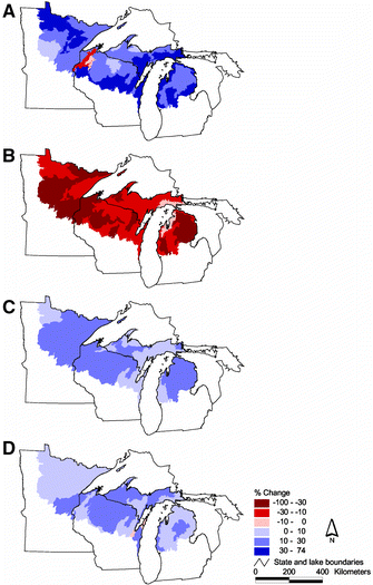
He suggests that, generally, ecological models fall in two seemingly exclusive categories, deterministic models and stochastic models, and that either category of model can use physical or empirical approaches, or a combination of both (see figure). However, the classification He presents in the paper is developed according to how models represent

  1. spatial processes,
  2. temporal processes,
  3. site-level succession, and
  4. the intended use of the model.

Models are classified by succession based on whether the model uses succession pathways (i.e., a Markov state-and-transition approach), vital attributes (as I utilised in my PhD modelling), or by coupling landscape models with more detailed stand-level vegetation succession models. The fourth classification criteria above highlights that there are numerous applications of forest landscape models, and that design is strongly related to the desired applications. He suggests applications of forest landscape models generally fall into one of three categories:

  1. spatiotemporal patterns of model objects,
  2. sensitivities of model object to input parameters, and
  3. comparisons of model simulation scenarios.

After developing and presenting the classification, the paper goes on to discuss two dilemmas facing those using forest landscape models. The first is the validation of model results, which has been discussed on numerous occasion elsewhere (including this blog). The discussion on circular reasoning is more novel however, (and related in some ways to what I have written with regards models of human agents):

“It is often difficult to separate expected results from emergent results. A caution against circular reasoning is the caveat often encountered in this situation, where researchers discuss biological or environmental forcing (causes) of their modeled results, whereas the forcing (causes) is actually built in the model formulation to derive such results. It should be pointed out that most model simulations do not lead to new understanding of the modeled processes themselves. The primary and subsequent results simply reflect the relationships used in building the models, which in turn reflect current understanding of the processes. The findings of these models are simply the spatiotemporal variations of the spatial process (discussed in Section 5.1), not the mechanisms that drive the potential changes of the spatial process. Emergent results are generally those resulted from the interactions and feedbacks of model objects.”


The paper concludes by summarizing likely development of forest landscape modelling in the future:

  1. Model development will move from the foci of theoretical and exploratory purposes to the foci of strategic and tactical purposes with increasing model realism, responding to the needs of forest management and planning.
  2. Multiple spatial and temporal resolutions will be implemented for different processes
  3. Standardized module components may emerge as handy utilities that are ready to be plugged into other models. Since component-based models provide non-developers or end users with access to model components, a component-based model can be more rigorously tested, evaluated, and modified than before, and thus, model development processes can be driven not solely by original developers, but by the broader scientific community
  4. Synchronization of multiple ecological processes can be made possible with multiple computer processors. This will help deal with the limitation that ecological processes are simulated in a sequential order as determined by the executable program.
  5. Model memorization will be improved so that a forest landscape model not only memorizes vegetation, disturbance, and management status at the current and previous model iteration, but also the entire temporal sequence. This would allow more effective studies of legacies of forested landscapes responding to various disturbance and management activities.


Here’s the full paper citation and abstract:

He (2008) Forest landscape models: Definitions, characterization, and classification Forest Ecology and Management 254 (3) Pages 484-498

Abstract
Previous model classification efforts have led to a broad group of models from site-scale (non-spatial) gap models to continental-scale biogeographical models due to a lack of definition of landscape models. Such classifications become inefficient to compare approaches and techniques that are specifically associated with forest landscape modeling. This paper provides definitions of key terminologies commonly used in forest landscape modeling to classify forest landscape models. It presents a set of qualitative criteria for model classification. These criteria represent model definitions and key model implementation decisions, including the temporal resolution, number of spatial processes simulated, and approaches to simulate site-level succession. Four approaches of simulating site level succession are summarized: (1) no site-level succession (spatial processes as surrogates), (2) successional pathway, (3) vital attribute, and (4) model coupling. Computational load for the first three approaches is calculated using the Big O Notation, a standard method. Classification criteria are organized in a hierarchical order that creates a dichotomous tree with each end node representing a group of models with similar traits. The classified models fall into various groups ranging from theoretical and empirical to strategic and tactical. The paper summarizes the applications of forest landscape models into three categories: (1) spatiotemporal patterns of model objects, (2) sensitivities of model object to input parameters, and (3) scenario analyses. Finally, the paper discusses two dilemmas related to the use of forest landscape models: result validation and circular reasoning.

Keywords Forest landscape models; Spatially explicit; Spatially interactive; Definitions; Model characterization; Model classification

Tackling Amazonian Rainforest Deforestation

This week’s edition of Nature devotes an editorial, a special report and an interview to the subject of tropical rainforests and their deforestation. The articles highlight both the proximate causes and underlying driving forces of tropical deforestation, and the importance of human activity as an agent of change (via fire for example), in these socio-ecological systems.

The editorial considers the economics of rainforest destruction, with regards to global carbon emissions. It suggests that deforestation must be integrated into international carbon markets, to reward those countries that have been able to control the removal of forest land (such as India and Costa Rica). Appropriate accounting of tropical rainforest carbon budgets is required however, and the authors point to the importance of carbon budget modelling and the monitoring of (via satellite imagery for example) change in rainforest areas over large spatial extents. Putting an economic price on ‘ecosystem services’ is key to this issue, and the editorial concludes:

One of the oddly positive effects of global warming is that it has given the world the opportunity to build a more comprehensive and inclusive economic model by forcing all of us to grapple with our impact on the natural environment. We are entering a phase in which new ideas can be developed, tested, refined and rejected as necessary. If we find just one that can beat the conventional economic measure of gross domestic product, and can quantify some of the basic services provided by rainforests and other natural ecosystems, it will more than pay for itself.


The special report focuses on the efforts of the Brazilian government to curb the rate of deforestation in the their Amazonian forests. The Brazilian police force is blockading roads, conducting aerial surveys and inspecting agricultural and logging operations, to monitor human activities on the ground. Brazilian scientists meanwhile are monitoring the situation from space, and have developed methodologies and techniques that are leading the way globally in the remote monitoring of forests. The Brazilian government is a keen advocate of the sort of economic approaches to the issues of rainforest destruction highlighted in the editorial outlined above, and sees this rigorous monitoring as key to be able to show how much carbon they can save by preventing deforestation.

Halting the removal of forest cannot simply be left to carbon trading alone, however, and local initiatives need to be pursued. To ensure the forest’s existence is sustainable, local communities need to be able make money for themselves without chopping down the trees – if they can do this it will be their in their interests NOT to remove forest. But developing this incentive has not been straightforward. For example, some researchers have have suggested that as commodity prices for crops such as soya beans have increased (possibly due to increased demand for corn-based ethanol in the US) deforestation has increased as a result. Although the price of soya beans may be a contributing factor to rainforest removal, Ruth DeFries (who will be visiting CSIS and MSU next week as part of the Rachel Carson Distinguished Lecture Series) suggests that it is not the main driver. Morton et al. found that during for the period 2001-04, conversion of forest to agriculture peaked in 2003. This situation makes it clear that there are both proximate causes and underlying driving forces of tropical deforestation. The Nature special report suggests:

If the international community is serious about tackling deforestation, it will probably need to use a hybrid approach: helping national governments such as Brazil to fund traditional policies for enforcement and monitoring and enabling communities to experiment with a market-based approach.


But how long do policy-makers have to discuss this and get these measures in place? One set of research suggests 55% of the Amazon rainforest could be removed over the next two decades, and the complexity of the rainforest system means that a ‘tipping point’ (i.e., an abrupt transition) beyond which the system might not recover (i.e., reforestation would not be possible). The Nature interview with Carlos Nobre highlights this issue – the interactions of climate change with soil moisture and the potential for fire indicate that the there is risk of rapid ‘savannization’ in the eastern to southeastern Amazon as the regional climate changes. When asked what the next big question scientists need to address in the Amazon is, Nobre replies that the role of human-caused fire will be key:

Fire is such a radical transformation in a tropical forest ecosystem that biodiversity loss is accelerated tremendously — by orders of magnitude. If you just do selective logging and let the area recover naturally, perhaps in 20–30 years only a botanist will be able to tell that a forest has been logged. If you have a sequence of vegetation fires going through that area, forget it. It won’t recover any more.


As I’ve previously discussed, considering the feedbacks and interactions between systems is important when examining landscape vulnerabilities to fire. Along with colleagues I have examined the potential effects of changing human activity on wildfire regimes in Spain (recently we had this paper published in Ecosystems and you can see more wildfire work here). However, the integrated study of socio-economic and ecological systems is still very much in its infancy. And the processes of landscape change in the northern Mediterranean Basin and the Amazonian rainforest are very different; practically inverse (increases in forest in the former and decreases in the latter). As always, plenty more work needs to be done on these subjects, and with the potential presence of ‘tipping points’, now is an important time to be doing it.

Forest Ecology and Management Special Issue: Forest Landscape Modeling

In June 2006 the China Natural Science Foundation and the International Association of Landscape Ecology sponsored an international workshop of forest landscape modelling. The aim of the workshop was to facilitate a discussion on the progress made in the theory and application of forest landscape models. A special issue of Forest Ecology and Management, entitled Forest Landscape Modeling – Approaches and Appplications [Vol. 253, Iss. 3], presents 12 papers resulting from that meeting. In their editorial, He et al. summarise the papers, organising them into three sections that describe current activities in forest landscape modelling: (1) effects of climate change on forest vegetation, (2) forest landscape model applications, and (3) model research and development.

The LANDIS model is used in several of the papers on climate and human management of forest systems. Advances in the representation of processes that propagate spatially, including fire and seed dispersal, are discussed in several of the papers examining model research and development. He et al. conclude their editorial by reiterating why landscape models are a vital tool for better understanding and managing forested regions of the world:

The papers represented in the special issue of forest landscape modeling highlight the advances and applications of forest landscape models. They show that forest landscape models are irreplaceable tools to conduct landscape-scale experiments while physical, financial, and human constraints make real-world experiments impossible. Most of the results presented in this issue would not have been possible without the use of forest landscape models. Forest landscape modeling is a rapidly developing field. Its development and application will continually be driven by the actual problems in forest management planning and landscape-scale research. We hope that the papers contained in this special issue will serve both researchers and managers who are struggling to incorporate large-scale and long-term landscape processes into their management planning or research.

UP Deer Browse Experiment Recce

A few pictures from our trip to the UP study area this past week.

The fall was almost over. We were out on a recce to find sites for an experiment we’re setting up over the next couple of weeks to examine the impact of deer browse on seedlings of various conifer species.

We want to locate our seedling planting on both state and commercial lands – cutting had recently finished at this commercial site.

We also visited a deer exclosure set up to examine tree regeneration in the absence of deer browse (similar in many ways to our experiment). It’s not the best picture, but the effects of 12 years of protection can be seen – very little regeneration on the left of the fence but evidence of green juveniles on the right. These effects haven’t been quantified at this site but by sight alone there’s clearly difference outside s inside the exclosure.

Finally, not all the leaves had fallen. We were a couple of weeks late for the real colours, but some remained down on the Lake Michigan coastline.

Modeling Disturbance Spatially using the FVS

We plan to use the Forest Vegetation Simulator (FVS), developed by the USFS over the previous couple of decades, in our ecological-economic model of a managed forest landscape. This week I’ve been thinking a lot about how best to link a representation of white-tailed deer browse with the FVS.

Two good examples I’ve found of the modelling of forest disturbance using FVS are the Fire and Fuels Extension (FFE) developed at the USFS Rocky Mountain Research Station in collaboration with other parties, and the Westwide Pine Beetle Model developed by the Forest Health Technology Enterprise Team (FHTET).

The Fire and Fuels Extension to the Forest Vegetation Simulator (FFE-FVS) links the existing FVS, models that represent fire and fire-effects, and fuel dynamics and crowning submodels. The overall model is currently calibrated for northern Idaho, western Montana, and northeastern Washington. More details on the FFE-FVS can be found here, where you can also download this video about the extension:


The Westwide Pine Beetle Model simulates impacts of mountain beetle (Dendroctonus ponderosae Hokpins), western pine beetle (D. brevicomis Leconte), and Ips species for which western pines are a host. The model simulates the movement of beetles between the forest stands in the landscape using the Parallel Processor Extension (PPE) to represent multiple forest stands in FVS.

A recent paper by Ager and colleagues in Landscape and Urban Planning presents work that links both the FFE and the WPBM to FVS using the PPE:

We simulated management scenarios with and without thinning over 60 years, coupled with a mountain pine beetle outbreak (at 30 years) to examine how thinning might affect bark beetle impacts, potential fire behavior, and their interactions on a 16,000-ha landscape in northeastern Oregon. We employed the Forest Vegetation Simulator, along with sub-models including the Parallel Processing Extension, Fire and Fuels Extension, and Westwide Pine Beetle Model (WPBM). We also compared responses to treatment scenarios of two bark beetle-caused tree mortality susceptibility rating systems. As hypothesized, thinning treatments led to substantial reduction in potential wildfire severity over time. However, contrary to expectations, the WPBM predicted higher bark beetle-caused mortality from an outbreak in thinned versus unthinned scenarios. Likewise, susceptibility ratings were also higher for thinned stands. Thinning treatments favored retention of early seral species such as ponderosa pine, leading to increases in proportion and average diameter of host trees. Increased surface fuel loadings and incidence of potential crown fire behavior were predicted post-outbreak; however, these effects on potential wildfire behavior were minor relative to effects of thinning. We discuss apparent inconsistencies between simulation outputs and literature, and identify improvements needed in the modeling framework to better address bark beetle-wildfire interactions.

Whilst I’m still in the early stages of working out how our model will all fit together, it seems like an approach that takes a similar approach will be suitable for our purposes. We’ll need to develop a model that is able to represent the spatial distribution of the deer population across the landscape and that can specify the impact of those deer densities on the vegetation for given age-height classes (for each veg species). This model would likely then be linked with FVS via the the PPE. So concurrently over the next few months I’m going to be working on developing a model of deer density and browse impacts, coding this model into a structure that will link with FVS-PPE, and acquiring and developing data for model initialization.

Reference
Ager, A.A., McMahan, A., Hayes, J.L. and Smith, E.L. (2007) Modeling the effects of thinning on bark beetle impacts and wildfire potential in the Blue Mountains of eastern Oregon Landscape and Urban Planning 80:3 p.301-311

Homogenization of the northern U.S. Great Lakes Forests

An email sitting in my inbox this morning directed me toward an article in the latest issue of Landscape Ecology that directly addresses one of the issues I touched on in Saturday’s post; the ‘Maple-ization’ of the western UP Northern Hardwood forests via selective forest harvest and the resulting feedbacks with whitetailed deer populations.

Lisa Schulte and colleagues examined the regional-scale impacts of human land use in the northern U.S. Great Lakes region. They found an overall loss of forestland, lower forest species diversity, functional diversity, and structural complexity compared to pre-Euro-American settlement forests.

Generally, they found evidence of shifts from evergreen conifer (-27.0%) to deciduous hardwood (+22.8%) species between pre-Euro-American settlement and the present time. Specifically, they found marked increases in Aspen (+12.8%) and Maple (+10.1%) and decreases in Pine (-17.5%) and Hemlock (-11.3%) across the area as a whole. However, increases in northern hardwood species were not uniform, and Beech and Birch have decreased (~4% each).


A figure from their paper (above) maps the change in ecoregion characteristics for (A) the extent of open vegetation, (B) dominance of conifers, (C) dominance of aspen (combined Populus tremuloides and P. grandidentata), and (D) dominance of maple (combined Acer saccharum and A. rubrum).

In their discussion the authors (p.1100-01) go on to describe the issues present in our study area;

“Although forests have largely been reestablished across northern portions of the region [following destructive logging in the late 19th century], these forests are on a new trajectory of change rather than recovery toward pre-Euro-American conditions . We attribute lack of recovery to legacies associated with the initial, severe land use conversion, the persistent over-abundance of a keystone herbivore (white-tailed deer), and related management practices that are inattentive to processes that historically promoted vegetation diversity within the region.

The excessive deer abundance at present is a feedback of regional forest management; whitetailed deer at high densities are now regarded as a major threat to forest biodiversity and regeneration in the region and elsewhere (Rooney et al. 2004). The commercial logging that is now the most frequent and widespread forest disturbance across the region largely fails to mimic either the local or landscape effects of the historically prevalent disturbances of windthrow and fire (Mladenoff et al. 1993; Scheller and Mladenoff 2002). Rather, current practices of aspen clearcutting and single-tree selection in maple stands continues to foster this divergence and simplification of the forests by largely favoring their regeneration over a greater diversity of tree species (Crow et al. 2002).”

As I discussed just the other day, we’ll be using the model we’re currently developing to examine spatial scenarios directly related to this issue. For example one aim is to examine scenarios of forest management that allow the recreation of historical herbivore disturbance via spatial patterns of vegetation whilst ensuring the future economic sustainability of the forests.

Reference
Schulte, L.A., Mladenoff, D.J., Crow, T.R., Merrick, L.C., and Cleland, D.T. (2007) Homogenization of northern U.S. Great Lakes forests due to land use Landscape Ecology 22:7 1089-1103