Seeds and Quadtrees

The main reason I haven’t blogged much recently is because all my spare time has been taken up working on revisions to a paper submitted to Environmental Modelling and Software. Provisionally entitled ‘Modelling Mediterranean Landscape Succession-Disturbance Dynamics: A Landscape Fire-Succession Model’, the paper describes the biophysical component of the coupled human-natural systems model I started developing during my PhD studies. This biophysical component is a vegetation state-and-transition model combined with a cellular-automata to represent wildfire ignition and spread.

The reviewers of the paper wanted to see some changes to the seed dispersal mechanism in the model. Greene et al. compared three commonly used empirical seed dispersal functions and concluded that the log-normal distribution is generally the most suitable approximation to observed seed dispersal curves. However, dispersal functions using an exponential function have also been used. A good example is the LANDIS forest landscape simulation model that calculates the probability of seed fall (P) in a region between the effective (ED) and maximum (MD) seed distance from the seed source. For distances from the seed source (x) < ED, P = 0.95. For x > MD, P = 0.001. For all other distances P is calculated using the negative exponential distribution function is used as follows:
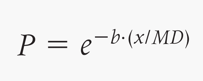
where b is a shape parameter.

Recently Syphard et al. modified LANDIS for use in the Mediterranean Type Environment of California. The two predominant pine species in our study area in the Mediterran Basin have different seed types: one (Pinus pinaster) has has wings and can fly large distances (~1km), but the other (Pinus pinea) does not. In this case a negative exponential distribution is most appropriate. However, research on the dispersal of acorns (from Quercus ilex) found that the distance distribution of acorns was best modeled by a log-normal distribution. I am currently experimenting with these two alternative seed dispersal distributions and comparing them with spatially random seed dispersal (dependent upon quantity but not locations of seed sources).

The main thing that has kept me occupied the last couple of weeks has been the implementation of these approaches in a manner that is computationally feasible. I need to run and test my model over several hundred (annual) timesteps for a landscape grid of data ~1,000,000 pixels. Keeping computation time down so that model execution does not take hundreds of hours is clearly important if sufficient model executions are to be run to ensure some form of statistical testing is possible. A brute-force iteration method was clearly not the best approach.

One of my co-authors suggested I look into the use of Quadtrees. Quadtrees are a tree data structure that are often used to partition a two dimensional space by recursively subdividing regions into quadrants (nodes). A region Quadtree partitions a region of interest into four equal quadrants. Each of these quadrants is subdivided into four subquadrants, each of which is subdivided and so on to the finest level of spatial resolution required. The University of Maryland have a nice Java applet example that helps illustrate the concept.

For our seed dispersal purposes, a region quadtree with n levels of may be used to represent an landscape of 2n × 2n pixels, where each pixel is assigned a value of 0 or 1 depending upon whether it contains a seed source of the given type or not. The distance of all landscape pixels to a seed source can then be quickly calculated using this data structure – staring at the top level we work our way down the tree querying whether each quadrant contains a pixel(s) that is a seed source. In this way, large areas of the grid can be discounted as not containing a seed source, thereby speeding the distance calculation.

Now that I have my QuadTree structure in place model execution time is much reduced and a reasonable number of model executions should be possible over the next month or so of model testing, calibration and use. My next steps are concerned with pinning down the appropriate values for ED and MD in the seed dispersal functions. This process of parameterization will take into account values previously used by similar models in similar situations (e.g. Syphard et al.) and empirical research and data on species found within our study area (e.g. Pons and Pausas). The key thing to keep in mind with these latter studies is their focus on the distribution of individual seeds from individual trees – the spatial resolution of my model is 30m (i.e. each pixel is 30m square). Some translation of values for individuals versus aggregated representation of individuals (in pixels) will likely be required. Hopefully, you’ll see the results in print early next year.

Forest Fire Cellular Automata


One of the examples I used in class this week when talking about ‘Complex Systems’ and associated modelling approaches was the Forest Fire Cellular Automata model. I’ve produced an implementation of the model in NetLogo, complete with plots to illustrate the frequency-area scaling relationship of the resulting wildfire regime. I’ve updated the wildfire behaviour page on my website to include an applet of the NetLogo model (if that page gets changed in the future, you can view and experiment with the model here).

Regional partitioning for wildfire regime characterization

Fighting wildfires is a strategic operation. In fire-prone areas of the world, such as California and the Mediterranean Basin, it is important that managers allocate and position fire trucks, water bombers and human fire-fighters in locations that minimize the response time to reach new fires. Not only is this important to reduce risk to human lives and livelihoods, the financial demands of fighting a prolonged campaign against multiple fires demands that resources be used as economically as possible.

Characterizing the wildfire regime of an area (the frequency, timing and magnitude of all fires) can be very useful for this sort of planning. If an area burns more frequently, or with greater intensity, on average, fire-fighting resources might be better placed in or near these areas. The relationship between the frequency of fires and the area they burn is one the characteristics that is particularly interesting from this perspective.

As I’ve written about previously with colleagues, although it is well accepted that the frequency-area distribution of wildfires is ‘heavy-tailed’ (i.e. there are many, many more small fires than large fires), the exact nature of this distribution is still debated. One of the distributions that is frequently used is the power-law distribution. Along with my former advisors Bruce Malamud and George Perry, I examined how this characteristic of the wildfire regime, the power-law frequency-area distribution, varied for different regions across the continental USA (see Malamud et al. 2005). Starting with previously defined ‘ecoregions’ (area with characterized by similar vegetation, climate and topography) we mapped how the frequency-area relationship varied in space, finding a systematic change from east to west across the country.

More recently, Paolo Fiorucci and colleagues (Fiorucci et al. 2008) have taken a slightly different approach. Rather than starting with pre-defined spatial regions and calculating the frequency-area distribution of all the fires in each region, they have devised a method that splits a large area into smaller regions based on the wildfire data for the entire area. Thus, they use the data to define the spatial differentiation of regions with similar wildfire regime characteristics a posteriori rather than imposing the spatial differentiation a priori.

Fiorucci and his colleagues apply their method to a dataset of 6,201 fires (each with an area greater than 0.01 sq km) that burned between 1987 and 2004 in the Liguria region of Italy (5400 sq km). They show that estimates of a measure of the wildfire frequency-area relationship (in this case the power-law distribution) of a given area varies significantly depending on how regions within that area are partitioned spatially. Furthermore, they found differences in spatial patterns of the frequency-area relationship between climatic seasons.

Using both a priori (the approach of Malamud et al. 2005) and a posteriori (the approach of Fiorucci et al. 2008) spatial delineation of wildfire regime areas, whilst simultaneously considering patterns in the processes believed to be driving wildfire regimes (such as climate, vegetation and topography), will lead to better understanding of wildfire regimes. That is, future research in this area will be well advised to look at the problem of wildfire regime characterization from both perspectives – data-driven and process-driven. The approach developed by Fiorucci et al. also provide much promise for a more rigorous, data-driven, approach to make decisions about the allocation and positioning of wildfire fire-fighting resources.

Citation and Abstract
Fiorucci, P., F. Gaetani, and R. Minciardi (2008) Regional partitioning for wildfire regime characterization, Journal of Geophysical Research, 113, F02013
doi:10.1029/2007JF000771

Wildfire regime characterization is an important issue for wildfire managers especially in densely populated areas where fires threaten communities and property. The ability to partition a region by articulating differences in timing, frequency, and intensity of the phenomena among different zones allows wildfire managers to allocate and position resources in order to minimize wildfire risk. Here we investigate “wildfire regimes” in areas where the ecoregions are difficult to identify because of their variability and human impact. Several studies have asserted that wildfire frequency-area relationships follow a power law distribution. However, this power law distribution, or any heavy-tailed distribution, may represent a set of wildfires over a certain region only because of the data aggregation process. We present an aggregation procedure for the selection of homogeneous zones for wildfire characterization and test the procedure using a case study in Liguria on the northwest coast of Italy. The results show that the estimation of the power law parameters provides significantly different results depending on the way the area is partitioned into its various components. These finds also show that it is possible to discriminate between different wildfire regimes characterizing different zones. The proposed procedure has significant implications for the identification of ecoregion variability, putting it in a more mathematical basis.

JASSS Paper Accepted

This week one of the papers I have been working on as a result of my PhD research has been accepted for publication in the Journal of Artificial Societies and Social Simulation (JASSS). The paper, written with Raúl Romero-Calcerrada, John Wainwright and George Perry, describes the agent-based model of agricultural land-use decision-making we constructed to represent SPA 56 in Madrid, Spain. We then present results from our use of the model to examine the importance of land tenure and land use on future land cover and the potential consequences for wildfire risk. The abstract is below, and I’ll post again here when the paper is published and online.

An Agent-Based Model of Mediterranean Agricultural Land-Use/Cover Change for examining Wildfire Risk

James D. A. Millington, Raúl Romero-Calcerrada, John Wainwright, George L.W. Perry
(Forthcoming) Journal of Artificial Societies and Social Simulation

Abstract
Humans have a long history of activity in Mediterranean Basin landscapes. Spatial heterogeneity in these landscapes hinders our understanding about the impacts of changes in human activity on ecological processes, such as wildfire. Use of spatially-explicit models that simulate processes at fine scales should aid the investigation of spatial patterns at the broader, landscape scale. Here, we present an agent-based model of agricultural land-use decision-making to examine the importance of land tenure and land use on future land cover. The model considers two ‘types’ of land-use decision-making agent with differing perspectives; ‘commercial’ agents that are perfectly economically rational, and ‘traditional’ agents that represent part-time or ‘traditional’ farmers that manage their land because of its cultural, rather than economic, value. The structure of the model is described and results are presented for various scenarios of initial landscape configuration. Land use/cover maps produced by the model are used to examine how wildfire risk changes for each scenario. Results indicate land tenure configuration influences trajectories of land use change. However, simulations for various initial land-use configurations and compositions converge to similar states when land-tenure structure is held constant. For the scenarios considered, mean wildfire risk increases relative to the observed landscape. Increases in wildfire risk are not spatially uniform however, varying according to the composition and configuration of land use types. These unexpected spatial variations in wildfire risk highlight the advantages of using a spatially-explicit ABM/LUCC.

April 2008 Conference Posters


Final preparations are underway for the US-IALE Symposium in Madison, WI, next week. I’ve finished the poster that we’ll be presenting there on the progress we’re making withour ecological-economic forest landscape model. We’ve also been putting the finishing touches on our posters for the wildfire session at EGU in Vienna (which Raul will be attending and presenting our posters at). Links to .pdf versions of the posters are below. Thoughts and photos from Madison and Chicago (where I’ll be stopping off for a couple of days on the way home) on my return.

An Ecological-Economic Model for Sustainable Forest Management: Modeling Deer Distributions from Local & Landscape Characteristics
J.D.A. Millington, J.P. LeBouton, M.B. Walters, K.R. Hall, M.S. Matonis, E.J. Laurent, F. Lupi, S. Chen, J. Liu

An Integrated Socio-Ecological Simulation Model of Succession-Disturbance Dynamics in a Mediterranean Landscape
J.D.A. Millington, J. Wainwright, G.L.W. Perry, R. Romero-Calcerrada, & B.D. Malamud

Spatial modelling of the influence of human activity on wildfire ignition risk in a Mediterranean landscape
R. Romero-Calcerrada, F. Barrio-Parra, J.D.A. Millington, C.J. Novillo

Tackling Amazonian Rainforest Deforestation

This week’s edition of Nature devotes an editorial, a special report and an interview to the subject of tropical rainforests and their deforestation. The articles highlight both the proximate causes and underlying driving forces of tropical deforestation, and the importance of human activity as an agent of change (via fire for example), in these socio-ecological systems.

The editorial considers the economics of rainforest destruction, with regards to global carbon emissions. It suggests that deforestation must be integrated into international carbon markets, to reward those countries that have been able to control the removal of forest land (such as India and Costa Rica). Appropriate accounting of tropical rainforest carbon budgets is required however, and the authors point to the importance of carbon budget modelling and the monitoring of (via satellite imagery for example) change in rainforest areas over large spatial extents. Putting an economic price on ‘ecosystem services’ is key to this issue, and the editorial concludes:

One of the oddly positive effects of global warming is that it has given the world the opportunity to build a more comprehensive and inclusive economic model by forcing all of us to grapple with our impact on the natural environment. We are entering a phase in which new ideas can be developed, tested, refined and rejected as necessary. If we find just one that can beat the conventional economic measure of gross domestic product, and can quantify some of the basic services provided by rainforests and other natural ecosystems, it will more than pay for itself.


The special report focuses on the efforts of the Brazilian government to curb the rate of deforestation in the their Amazonian forests. The Brazilian police force is blockading roads, conducting aerial surveys and inspecting agricultural and logging operations, to monitor human activities on the ground. Brazilian scientists meanwhile are monitoring the situation from space, and have developed methodologies and techniques that are leading the way globally in the remote monitoring of forests. The Brazilian government is a keen advocate of the sort of economic approaches to the issues of rainforest destruction highlighted in the editorial outlined above, and sees this rigorous monitoring as key to be able to show how much carbon they can save by preventing deforestation.

Halting the removal of forest cannot simply be left to carbon trading alone, however, and local initiatives need to be pursued. To ensure the forest’s existence is sustainable, local communities need to be able make money for themselves without chopping down the trees – if they can do this it will be their in their interests NOT to remove forest. But developing this incentive has not been straightforward. For example, some researchers have have suggested that as commodity prices for crops such as soya beans have increased (possibly due to increased demand for corn-based ethanol in the US) deforestation has increased as a result. Although the price of soya beans may be a contributing factor to rainforest removal, Ruth DeFries (who will be visiting CSIS and MSU next week as part of the Rachel Carson Distinguished Lecture Series) suggests that it is not the main driver. Morton et al. found that during for the period 2001-04, conversion of forest to agriculture peaked in 2003. This situation makes it clear that there are both proximate causes and underlying driving forces of tropical deforestation. The Nature special report suggests:

If the international community is serious about tackling deforestation, it will probably need to use a hybrid approach: helping national governments such as Brazil to fund traditional policies for enforcement and monitoring and enabling communities to experiment with a market-based approach.


But how long do policy-makers have to discuss this and get these measures in place? One set of research suggests 55% of the Amazon rainforest could be removed over the next two decades, and the complexity of the rainforest system means that a ‘tipping point’ (i.e., an abrupt transition) beyond which the system might not recover (i.e., reforestation would not be possible). The Nature interview with Carlos Nobre highlights this issue – the interactions of climate change with soil moisture and the potential for fire indicate that the there is risk of rapid ‘savannization’ in the eastern to southeastern Amazon as the regional climate changes. When asked what the next big question scientists need to address in the Amazon is, Nobre replies that the role of human-caused fire will be key:

Fire is such a radical transformation in a tropical forest ecosystem that biodiversity loss is accelerated tremendously — by orders of magnitude. If you just do selective logging and let the area recover naturally, perhaps in 20–30 years only a botanist will be able to tell that a forest has been logged. If you have a sequence of vegetation fires going through that area, forget it. It won’t recover any more.


As I’ve previously discussed, considering the feedbacks and interactions between systems is important when examining landscape vulnerabilities to fire. Along with colleagues I have examined the potential effects of changing human activity on wildfire regimes in Spain (recently we had this paper published in Ecosystems and you can see more wildfire work here). However, the integrated study of socio-economic and ecological systems is still very much in its infancy. And the processes of landscape change in the northern Mediterranean Basin and the Amazonian rainforest are very different; practically inverse (increases in forest in the former and decreases in the latter). As always, plenty more work needs to be done on these subjects, and with the potential presence of ‘tipping points’, now is an important time to be doing it.

Landscape Ecology paper In Press

We were informed this week that the paper I have been working on with Raul Romero Calcerrada and other colleagues at Universidad Rey Juan Carlos has been accepted by Landscape Ecology. I’ve copied the abstract below. It should be out later in 2008, but email me if you want a pre-print.

Currently I’m working on two paper with colleagues describing the construction and initial results of the model I constructed during my PhD research. We’re also submitting abstracts to the European Geophysics Union General Assembly 2008 on this and work related to the Landscape Ecology paper.

The abstract submitted with colleagues at CSIS has been accepted for poster presentation at the US-IALE meeting in Madison in April. Should be a good meeting. Also, the doi for Perry and Millington (2008) in PPEES now works.

Tomorrow I’m heading back to Europe for a couple of weeks. I have my PhD graduation ceremony next week (maybe I’ll post some photos of me looking scholarly/awkward in my academic dress/get-up), a couple days snowboarding in the Swiss Alps, and a couple of days working with Bruce Malamud at King’s following up on the work we published on US wildfire regimes in PNAS. Should be a fun couple of weeks!

GIS analysis of spatial patterns of wildfire human-caused ignition risk in the SW of Madrid (Central Spain) (In Press) Landscape Ecology

Raul Romero Calcerrada; Carlos J. Novillo Camacho; James DA Millington; Inmaculada Gomez-Jimenez

Abstract: The majority of wildfires in Spain are caused by human activities. However, much wildfire research has focused on the biological and physical aspects of wildfire, with comparatively less attention given to the importance of socio-economic factors. With recent changes in human activity and settlement patterns in many parts of Spain, potentially contributing to the increases in wildfire occurrence recently observed, the need to consider human activity in models of wildfire risk for this region are apparent. Here we use a method from Bayesian statistics, the Weights of Evidence (WofE) model, to examine the causal factors of wildfires in the south west of the Madrid region for two differently defined wildfire seasons. We also produce predictive maps of wildfire risk. Our results show that spatial patterns of wildfire ignition are strongly associated with human access to the natural landscape, with proximity to urban areas and roads found to be the most important causal factors. We suggest these characteristics and recent socio-economic trends in Spain may be producing landscapes and wildfire ignition risk characteristics that are increasingly similar to Mediterranean regions with historically stronger economies, such as California, where the urban-wildland interface is large and recreation in forested areas is high. We also find that the WofE model is useful for estimating future wildfire risk. We suggest the methods presented here will be useful to optimize time,
human resources and fire management funds in areas where urbanization is increasing the urban-forest interface and where human activity is an important cause of wildfire ignition.

Update 06/02/08: This paper is now online here and here.

Seeing the Wood for the Trees: Pattern-Oriented Modelling

A while back I wrote about the potentially misplaced preoccupation with statistical power in species distribution models. Our attempts at drawing out some relationships between our deer distribution data and descriptors of land cover is proving taxing – the relationships evident at a more coarse spatial resolution (e.g. county level) than we are considering aren’t found in our stand-level data. As a result we moving toward taking a modelling approach that is driven less by our empirical data and more by inferences based on multiple information sources. Particularly I’m drawn toward emphasising an approach I first encountered in my undergraduate landscape ecology class taught by George Perry – ‘Pattern-Oriented Modelling‘.

A prime example of the POM approach is its use to model the spread of rabies through central Europe. The rabies virus has been observed to spread in a wave-like manner, carried by foxes. Grimm et al. (1996) describe how they developed a cellular automate-type model that considers cells (of fox territory) to be in either a healthy, infected or empty state. Through an iterative model development process, their model was gradually refined (i.e. its assumptions and parameters modified) by comparing model results with empirical patterns.

The idea underpinning this iterative POM approach is

“… if we decide to use a pattern for model construction because we believe this pattern contains information about essential structures and processes, we have to provide a model structure which in principle allows the pattern observed to emerge Whether it does emerge depends on the hypotheses we have built into the model.”

This approach has been found particularly useful for the development of ‘bottom-up’ agent-based models. Often understanding of the fine-scale processes driving broad-scale system dynamics and patterns is poor, making it difficult to both structure and parameterise mechanistic models. However, whilst the logical fallacy of affirming the consequent remains, if a model of low-level interactions is able to reproduce higher-level patterns, we can be confident that our model is a better representation of the system mechanics than one that doesn’t. Furthermore, the more patterns at different scales that the model reproduces, the mode confident we can be in it. Thus, in POM

“multiple patterns observed in real systems at different hierarchical levels and scales are used systematically to optimize model complexity and to reduce uncertainty.”Grimm et al. (2005)

Grimm and Berger outline the general protocol of a pattern-oriented modelling approach (whilst reminding us that there is no standard recipe for model development):

  1. Formulate the question or problem
  2. Assemble hypotheses about essential processes and structures
  3. Assemble (observed) patterns
  4. Choose state variables, parameters and structures
  5. Construct the model
  6. Analyse, test and revise the model
  7. Use patterns for parameterisation
  8. Search for independent predictions

Several iterations of this process will be required to refine the model. In initial iterations, steps 2 and 4 may need to be largely inferential if the state of knowledge about the system is poor. However, by moving iteratively back through these steps, and in particular exploiting steps 6 and 7 to inform us about model performance relative to system behaviour, we can improve our knowledge about the system whilst simultaneously ensuring our model recreates observed patterns. For example, during the development of the landscape fire-succession model in my PhD, I compared the landscape-level model results of different sets of (unknown) flammability probabilities (parameters) of each vegetation type required by the model with empirically observed wildfire regime behaviour. By modifying parameters for individual vegetation types I was able to reproduce the appropriate wildfire frequency-area distribution for Mediterranean-type environments that had previously been found (I’m currently writing this up for publications – more soon).

But what does this all have to do with our model of the relationship between deer browse and timber harvest in Michigan’s Upper Pensinsula? Well, right now I think we’re at steps 2,3 and 4 (all at the same time). As our deer and land cover relationships are weak at the stand-level (which is the level we are considering so that we can integrate the model with an economic module), I am currently developing hypotheses (i.e. assumptions) about the structure of the system from previous research on different specific aspects of similar systems. Furthermore, we’re continuing to look for spatial patterns in both vegetation and deer distribution so that we can compare the results of our hypothetical model.

For example, one thing I’m struggling with right now is is how to establish the probability of which individual trees (or saplings) will be removed from a stand due to a given level of deer browse (which in turn is dependent upon a deer density). This is not something that has been explicitly studied (and would be very difficult to study at the landscape level). Therefore we need to parameterise this process in order for the model to function. We should be able to do this by comparing several different parameterisations to empirically observed patterns such as spatial configuration of forest types classified by age class or age/species distributions at the stand-level. That’s the idea anyway – we’ll see how it goes over the next months…

In the meantime, next week I head back to the study area for the first stage of our seedling experiment. We’re planting seedlings now across a gradient of browse and site conditions with the intention of returning in the spring to see what has been browsed and count deer pellets. This should improve our understanding of the link between pellet counts and browse pressure and provide us with some more empirical patterns which we can use in our ongoing model development.

Call for Abstracts: Wildfires session at EGU 2008

As in previous years, I’m a co-convener of the Wildfires session at the 2008 European Geophysics Union General Assembly (along with Rosa Lasaponara, Luciano Telesca and Don McKenzie). We hope this year’s session will be as successful as ever, and are expecting the best papers presented to compose a special issue of Ecological Modelling. The call for abstracts is now open (copied below). Abstracts should be submitted at the conference website. Important deadlines are:

Abstract Submission: 14 January 2008
Financial Applications 07 December 2007
Pre-registration: 31 March 2008

Subject: Call for Abstracts: Wildfires session at EGU 2008

5 November 2007

Dear Colleagues [Apologies for cross-posting],

The European Geosciences Union (EGU) General Assembly 2008 is to be help from 13-18 April 2008 in Vienna, Austria. We invite you to participate in the session ‘Spatial and temporal patterns of wildfires: models, theory, and reality’ (NH8.4/BG2.16 – co-organized by the Natural Hazards & Biogeosciences divisions).

Session description:
Wildfires are the result of a large variety and number of interacting components, producing patterns that vary significantly both spatially and temporally. This session will examine models, theory, and empirical studies in wildfire research. We encourage submissions in any one or combination of these three main areas, and envision bringing together wildfire hazard managers, applied researchers, and theoreticians. Posters are also very much encouraged, as we plan to have both lively
oral and poster sessions.

The best papers will be considered for publication in a Special Issue of Ecological Modelling

ABSTRACT DEADLINE: 14 January 2008
Web site for submission: http://meetings.copernicus.org/egu2008/

Please note that the deadline for financial applications is 07 December 2007, and for pre-registration is 31 March 2008. We look forward to seeing you in Vienna. Please forward this message also to your colleagues.

With best regards,

Lasaponara, R. (Convener)
Telesca, L.; McKenzie, D.; Millington, J. (Co-conveners)

Lasaponara Rosa, PhD
Research on Remote Sensing and Signal Processing
CNR-IMAA
Italy
lasaponara at imaa.cnr.it

Luciano Telesca
Research on geoscience and Signal Processing
CNR-IMAA
Italy
luciano.telesca at imaa.cnr.it

Don McKenzie
Research Ecologist
Pacific WIldland Fire Sciences Lab
US Forest Service

Affiliate Professor
College of Forest Resources
CSES Climate Impacts Group
University of Washington

dmck at u.washington.edu
donaldmckenzie at fs.fed.us

James D.A. Millington, PhD
Research Associate
Center for Systems Integration and Sustainability
Michigan State University
jmil at msu.edu

W1: http://csis.msu.edu
W2: http://www.landscapemodelling.net

An Integrated Fire Research Framework

Integrated, multi- and inter-disciplinary studies are becoming increasingly demanded and required to understand the consequences of human activity on the natural environment. In a recent paper, Sandra Lavorel and colleagues highlight the importance of considering the feedbacks and interactions between several systems when examining landscape vulnerabilities to fire. They present a framework for integrated fire research that considers the fire regime as the central subsystem (FR in the figure below) and two feedback loops, the first with consequences for atmospheric and biochemical systems (F1) and the second that represents ecosystems services and human activity (F2). It is this second feedback loop in their framework that my research focuses.


To adequately quantify the fire-related vulnerability of different regions of the world the authors suggest that a better understanding of the relative contributions of climate, vegetation and human activity to the fire regime is required. For example, they suggest that an examination of the statistical relationships between spatio-temporal patterns evident in wildfire regimes and data on ecosystem structure, land use and other socio-economic factors. We made a very similar point in our PNAS paper and hope to continue to use the exponent (Beta) of the power-law frequency-area relationship that is evident in many model and empirical wildfire regimes to examine these interactions. One statistical relationship that might be investigated is between Beta and the level of forest fragmentations, thought to be a factor confounding research on the effects of fire suppression of wildfire regimes.

But the effects of landscape fragmentation can also be examined in a more mechanistic fashion using dynamic simulation models. Lavorel et al. mention the impacts of agricultural abandonment on the connectivity of fuels in Mediterranean landscapes which are attributed, in conjunction with a drier than average climate, to the exceptionally large fires that burned there during the 1990s. My PhD research examined the impacts of agricultural land abandonment on wildfire regimes in central Spain. I’m currently working on writing this work up for publication, but I plan on continuing to develop the model to more explicitly represent the F2 feedbacks loop shown in the figure above.

The potential socio-economic consequences of changing fire regimes are an area with a lot of room to improve our understanding. For example, some regions of the world, such as the Canadian boreal forest, are transitioning from a net sink for carbon to a net source (due to emission during burning). If carbon sinks are considered in future emission trading systems, regions such as are losing a potential future economic commodity. Lavorel et al. also discuss the interesting subject of potential land conflict due to mismatches in the time scales between land planning and fire occurrence. In Indonesia for example, years which burn large areas force re-allocation of land development plans by local government. Often however the processes of developing these plans is not fast enough to forestall the exploitation by local residents of the new land available for occupation and use.

The need for increased research in this area is highlighted by the case studies for Alaskan and African savannah ecosystems presented by Lavorel et al. Whilst discussion of the wildfire regime and atmospheric/biochemical feedbacks can be discussed in detail, poor understanding of the ecosystem services/human activity feedbacks prevents such detailed discussion.

The framework Lavorel et al. present is a very useful way to conceptualise and plan for future research in this field. They suggest (p.47-48) that “Assessments of vulnerability of land systems to fire demand regional studies that use a systemic approach that focuses on the feedback loops described here” and “… will require engaging a collection of multiscale and interdisciplinary regional studies”. In many respects, I expect my future work to contribute to this framework, particularly with regards the human activity (F2) feedback loop.